Showing posts with label photographs. Show all posts

2021-01-21

Sharing My Desktop PC Wallpaper Collections

When I'm not mountain biking or cycling, mapping trails or ranting about political or social issues I may be taking photographs. The last few years I have been using the better ones as computer wallpaper, changing it every five days or so. These are slideshows of these collections.

2019 and before


2020


2012-09-16

The Lime Kiln Technical Trail Will Never Be The Same

Today we finally had the opportunity to hike the Lime Kiln Technical Trail for the first time since the Lime Kiln area fire in the Stony Swamp Conservation Area.

(click on map to enlarge)

Things are looking pretty good for the first part of the trail, although you start to see larger and larger signs of fire as you look alongside the trail and then you are in the middle of the Fire Zone. At that point on the map you can see the hike diverging somewhat from the trail as we tried to follow the trail on the GPS and keep watch for the silver Rideau Trail triangles (silver because in most cases the blue paint was removed due to the heat of the fire). Most of the trail within the Fire Zone was unrecognizable although there were a few recognizable trail features along the route we followed.

The fire zone ended shortly before one of the fire roads crossed the trail. At that point the trail continues on the other side of the fire road but due to all the debris pushed up alongside the road we were unable to follow the trail. Knowing it reconnected further along the Fire Road we continued following the road, intending to follow it back from the other end, but when we reached that location we again had the problem of the piled up debris hiding the entrance into the trail, so we ended up missing about 200 metres of trail. After that the Fire Road wiped out most of the trail except for a short portion that ran just alongside it just before the Lime Kiln Bridge.

My guess would be, taking into account the first section of trail, and the section we by-passed, plus the short section of trail at the end, that close to 50% of the trail might be intact in it's original condition. The other 50% will probably need extensive rehabilitation and some of the technical features might never be recovered.

My inclination, however, would be that it would be best to let the natural environment and vegetation recover on it's own before attempting to rebuild the trail. We did notice that there already appeared to be some new growth within the fire zone and on the fire roads. At the appropriate time I would hope that the National Capital Commission (NCC) would consult with all trail users, including mountain bikers, in developing a trail rehabilitation plan.


(select 720p to view in high definition and full screen to view full screen)

2012-08-28

"Tour de Sudbury" - Cycling in Sudbury

Our hometown of Sudbury is not known for it's cycling infrastructure or even for a positive attitude towards cycling but there are organizations like the Sudbury Cyclists Union, the Rainbow Routes Association and the Sudbury Cycles Project that are trying to change that and there is even a proposed Bicycle Technical Master Plan For The City of Greater Sudbury.

It was the Rainbow Routes Association map of non-motorized trails in Sudbury that inspired us to try out some of the cycling routes in Sudbury as they did look promising.

We mixed a combination of Sudbury history and waterways in our route selection.

Looking to the history of Sudbury:

The City of Sudbury was founded in 1883 at a point on the railway known as Sudbury Junction, where the branch line to Algoma Mills joined the main line of the CPR. Prior to the establishment of the mining industry, (which occurred around 1900), Sudbury's stability and growth depended both on the railway and on the lumbering industry. (Source:)
We decided to create a route that started by following the historical Junction Creek along the Junction Creek Waterway Park and then went around Ramsey Lake and through the Lake Laurentian Conservation Area

click on map to enlarge

We started our ride at the Rotary Park by the Adanac Ski Hill in New Sudbury wwhere the City is building a BMX park and followed the Junction Creek Waterway Park pathway to downtown


It was a very enjoyable ride along a very scenic hard-packed gravel path. For the most part it was well signed and even on my Backroad Mapbooks background map on my GPS.

However when we came to transition to the connection to the "Tour de Sudbury" route along Ramsey Lake we had to rely on our map along with our previous knowledge of Sudbury to make the connection.

It was unclear from the trail map whether the route around Ramsey Lake was on a dedicated path or on the road, although the fact that it followed the roads exactly (except where it went through the conservation area) was a pretty good clue that it was mostly a road route, although most of it was on some of the few marked bike lanes that exist in Sudbury. It was still a pleasant ride and traffic did not seem threatening at all.

The most interesting part of the ride along Ramsey Lake began when we left the pavement and entered the Lake Laurentian Conservation Area and were away from "civilization" for awhile. You definitely wanted to be on a hybrid and not a high-end road bike in this section especially for a few loose gravel downhill sections. The scenery was lovely especially near the boardwalk.


(select 720p to view in high definition and full screen to view full screen)

And it stayed interesting when we rejoined the pavement at South Bay Road and what must have been the steepest uphill I have ever ridden. Thanks to our Ireland bike tour I was able to climb the whole thing, albeit with some rest stops.

After a few more ups and downs it was back on the flat and continuing our ride till we stopped at Science North for lunch, then on along the pathway along Ramsey Lake through Bell Park, back over the old Iron Bridge and and back along the creek to the start of our very enjoyable journey.


We hope to check out some more of the cycling opportunities in Sudbury on future trips up north.

2012-08-23

Ireland Bike Tour - Post Bike Tour Slide Shows

After the bike tour we stayed in Ennis for a few days and took a bus to Limerick for a day tour.

The most interesting observation we made was that while Ennis had narrow streets with one lane one way traffic and narrow sidewalks, much of Limerick had wide streets with one lane one way traffic and very wide sidewalks. And both towns had portions of their centre cores that were pedestrian only.

While in Limerick we visited King John's Castle.


(select 720p to view in high definition and full screen to view full screen)

(select 720p to view in high definition and full screen to view full screen)
The slide shows above portray the streetscapes and scenes of Limerick, followed by King John's Castle. The slide show below features those wonderful red Irish flowers in Ennis.


(select 720p to view in high definition and full screen to view full screen)

2012-08-19

Ireland Bike Tour - Cycling Day 6 Slide Show

This was the longest ride of the tour but not too bad as far as hills go, except for the last ride into Westport, up and down and then back up and down again. Lots of scenery but not too many photo stops because of the long ride and then drive back to Ennis in the van.


(select 720p to view in high definition and full screen to view full screen)

The slide show above starts with the obligatory photo of a rainbow in front of a mountain and features more of the Irish landscape, including hills and streams, and of course sheep, as well as the Irish famine memorial.

2012-08-09

Ireland Bike Tour - Break Day Slide Show

We took today easy, went for a walk near the lodge on Lough Inagh in the morning and managed to talk Jeff into driving us to the Kylemore Abbey in the afternoon where we explored the grounds and the remarkable gardens. There is some real interesting history about this place.


(select 720p to view in high definition and full screen to view full screen)

The slide show above features the mountains and landscape near the lodge followed by the Kylemore Abbey and gardens.

2012-08-06

Ireland Bike Tour - Cycling Day 5, Sheep Shearing, Flowers and More Slide Shows

If you’ve ever been to a county fair or watched a movie about Australia you have seen sheep sheering, but usually with electric shears. In this part of Ireland they use hand shears and probably sheer the sheep faster and cleaner than with the electric ones. This was a great day for photos, including a good number of flower close-ups. There was a really great mountain behind our Lodge that I was so tempted to try to climb up.


(select 720p to view in high definition and full screen to view full screen)

The slide show above features more of the Irish landscape including ruins, mountains, streams and beaches, as well as sheep and sheep shearing and ends with lovely views from our hotel.

The slide show below features Irish flowers.


(select 720p to view in high definition and full screen to view full screen)

2012-08-04

Ireland Bike Tour - Cycling Day 4, Discovering Ireland's Sheep Slide Show

Today was a day at the beach as we stopped at a wonderful little beach along the route, as well as made a visit to the lovely town of Clifden. More scenery, and did I mention the sheep. The sheep in Ireland seem to have priority over the roads, followed by bicycles and then cars.


(select 720p to view in high definition and full screen to view full screen)

The slide show above starts with a view from our hotel dining room followed by views of the grounds, then it's on to the landscape with an emphasis on geology. We have our first encounters with Ireland’s sheep, as well as stop for a visit to a lovely beach. Final views are from our new hotel room window followed by a visit to the town of Clifden.

2012-08-02

Ireland Bike Tour - Cycling Day 3, The Aran Islands Slide Show

Most of the day was spent on one of the Aran Islands. It was a great day for photography as it was actually sunny and there was so much to photograph, from a remarkable fort to literally hundreds (maybe thousands) of stone fences from millions of stones dividing up the tiny allotments that people had to tend to survive from farming. Did I mention the dolphins swimming around in the harbour beside the ferry, which unfortunately we took no photos of.


(select 720p to view in high defintion and full screen to view full screen)

The slide show above is mostly concentrated on the remarkable landscape of the Aran Islands followed by some photos of the mainland landscape ending at The Cashel House, a lovely country inn sitting beside Bertraghboy Bay.

2012-07-27

Ireland Bike Tour - Cycling Day 2, To The Burren Slide Show

Today we did a circle route through the remarkable Burren, a landscape that almost defies description, although parts of Ottawa's Lime Kiln Trail with it's underlying Limestone hints at it. And, of course it's Ireland so there were more ruins. This was the second hardest climbing day of the tour.


(select 720p to view in high definition and full screen to view full screen)

The slide show above starts with a view from our hotel room and covers more of the Irish landscape, more ruins of churches and castles, cemeteries and stone fences and finishes going through the remarkable geology of the Burren.

2012-07-26

Ireland Bike Tour - Cycling Day 1, The Irish Landscape Slide Show

Today we got setup on our bikes with our self-guiding instructions so we could ride on our own while Jeff went ahead with the van and then would mysteriously appear on his bike cycling towards us to make sure we were not lost. We rode to the Cliffs of Moher which reportedly has spectacular views, but all we saw was fog. But after the longest climb of the trip, 220 metres, we were not riding back up there again no matter how sunny the next day was.


(select 720p to view in high definition and full screen to view full screen)

The slide show above features the remarkable Irish landscape including those famous stone fences, a scenic beach, ruins of castles and a remarkable old cemetery, but no photos of the Cliffs of Fog.

2012-07-25

Ireland Bike Tour - Ennis Slide Show

We arrived a few days early and got to know the town of Ennis which was full of stone walls, first thing we noticed, and lots of local shops and pubs - no Walmarts or big box stores. The only chain store we noticed was a large Irish department store, Dunnes. The other big attraction is the Fergus River.


(select 720p to view in high definition and full screen to view full screen)

The slide show above features:

The Old Ground Hotel
Residential Streetscapes
Ennis Friary (being restored)
Fergus River
Ducks along the Fergus River
Downtown Ennis
The Suburbs (1960s style houses rather than 1860s style houses)

2011-08-13

When Beavers Abandon Their Dam: Heron Pond, South March Highlands

This summer a breach in the dam at Heron Pond in the South March Highland was discovered that appeared to be a natural occurrence. In such cases the beavers will usually repair the dam, but this did not happen and it appears they have abandoned the dam and the pond. This has caused the water levels in Heron Pond to drop dramatically so that what once appeared to be a lake now appears to be drying up.

This has caused concern amongst nature lovers and others who appreciate hiking and biking along the pond, but in reality it might provide an opportunity to observe and study a changing ecosystem if the beavers do not return to the pond and it gradually reverts to forest or pasture or a yet to be determined other natural state.

The following photos were taken before and after the beavers abandoned the pond. The first two in each series were taken from what mountain bikers call The Shield, a flat rocky area on the trail that goes through the Metcalfe Realty lands northeast of the pond. The last three photos in each set were taken from what mountain bikers call Pete's Wicked Trail in the city-owned South March Highlands Conservation Forest southwest of the pond.

Click on the images to see enlarged versions

BEFORE


AFTER


2011-08-12

The Geology of Kakakiwaganda Lake (Rock Lake)

Every summer we spend about a week at our favourite Bed and Breakfast Whispering Pines On the Bay which is about half-way between Sudbury and Killarney Provincial Park. Not only does it have gracious friendly hosts and interesting guests from all over the world, it is also located on beautiful Kakakiwaganda Lake, or as the l̶o̶c̶a̶l̶s̶  settlers (edit 2023-09-11) call it, Rock Lake.

We also get out kayaking on the lake at least once every visit and one of the most interesting things about the lake is the geology and rock formations along the shore. The photographs in the slide show below were taken from my kayak as I paddled around the lake.


(select 720p to view in high definition and full screen to view full screen)

2010-11-02

Beautiful Calendars For Christmas Gifts

Are you looking for a unique Christmas gift for your friends and family. Is your company looking for a unique way to recognize your employees this holiday season. For only $20 each you can purchase beautiful calendars with high quality photos of Ottawa's beautiful South March Highlands taken by local photographers.

I cannot say enough about how beautiful and unique these calendars are. We have purchased many for gifts for our friends. This is a great opportunity to give your friends unique gifts and help save Ottawa's beautiful South March Highlands. Proceeds from calendar sales go to the Coalition to Protect the South March Highlands (South March Highlands - Carp River Conservation Inc.).

Click Here To Order A Beautiful Calendar

No shipping charge for orders in the Ottawa area.

2010-09-30

Ottawa River Pathway Two Solitudes: PostScript

Yesterday I was down by the canal locks looking over at the "missing link" and realized there may be some sections where it is a challenge to continue the pathway along the river at the bottom due to the terrain. But there is a solution. These photos are from the boardwalk along Ramsey Lake in Bell Park in Sudbury

(Click on Photos to Enlarge)


2010-09-21

Trail Building School in the South March Highlands

This past weekend I had the good fortune to attend a trail building school held by the people who invented sustainable trail building and literally wrote the books on it, the International Mountain Bicycling Association's IMBA Canada Trail Care Crew:

Supported by Parks Canada and the Trans Canada Trail (TCT) and directed by the International Mountain Bicycling Association Canada (IMBA Canada), the IMBA Canada Trail Care Crew works with IMBA Canada-affiliated mountain bike clubs, TCT Provincial and Territorial organizations, Parks Canada and other trail user groups. Its mandate is to build new trails, maintain and restore existing trails, participate in solving trail management challenges, and to promote trails in order to improve trail conditions and trail experiences for everyone.

The IMBA Canada Trail Crew is a dynamic two-person team of professional trail builders that will travel throughout Canada year-round.

The work that the crew will do will benefit all types of trail users including hikers, horseback riders, mountain bikers, cross country skiers, snowshoers, bird watchers, and all other outdoor opportunities that use trails.

Source: Parks Canada website
Sustainable trail building is not just about mountain biking, and indeed most MTB trails are shared trails and IMBA has been working with other trail users in providing education and has trained people from the National Capital Commission (NCC) and Parks Canada in sustainable trail building methods. Parks Canada is currently revising their trail building manuals to reflect IMBA guidelines, and the NCC seems to be going through a slow shift in their attitude to mountain biking.

The first thing we learned at trail building school is that water runs downhill, well actually that was the second thing we learned. The first thing we learned was that planning is the most important part of trail building and should have the most time devoted to it. Key points are that all trail users need to be considered in planning a trail and that route design can be key in making a trail sustainable.

This is where the water runs downhill part comes in. One of the biggest factors in sustainable trail building is avoiding erosion so that designing a trail so that water runs off it rather than along it is key, and much of what we learned had to do with the degree of incline and slope of a trail. The bench cut method is one way of doing that. Some of the things we learned are described here.

Other factors in designing trails include keeping them away from fragile habitats of endangered species, the Blandings Turtle was mentioned, indicating that the Trail Care Crew was familiar with the SMH situation.

During the trail building school we got to meet many new people and learn a lot of new information, some of it not directly related to trail building techniques, such as the fact that OMBA has been given permission by the City to post signs on the SMH trails to help bikers and hikers know where they are and find their way out. I expect the signs will be in place by next spring. I also learned that the City of Ottawa's draft trail plan for the South March Highlands, with its inappropriate trail closures and denaturalization of trails, is apparently dead. Hopefully it will be back to the drawing board with proper consultations with the public and experts in trail design and building.

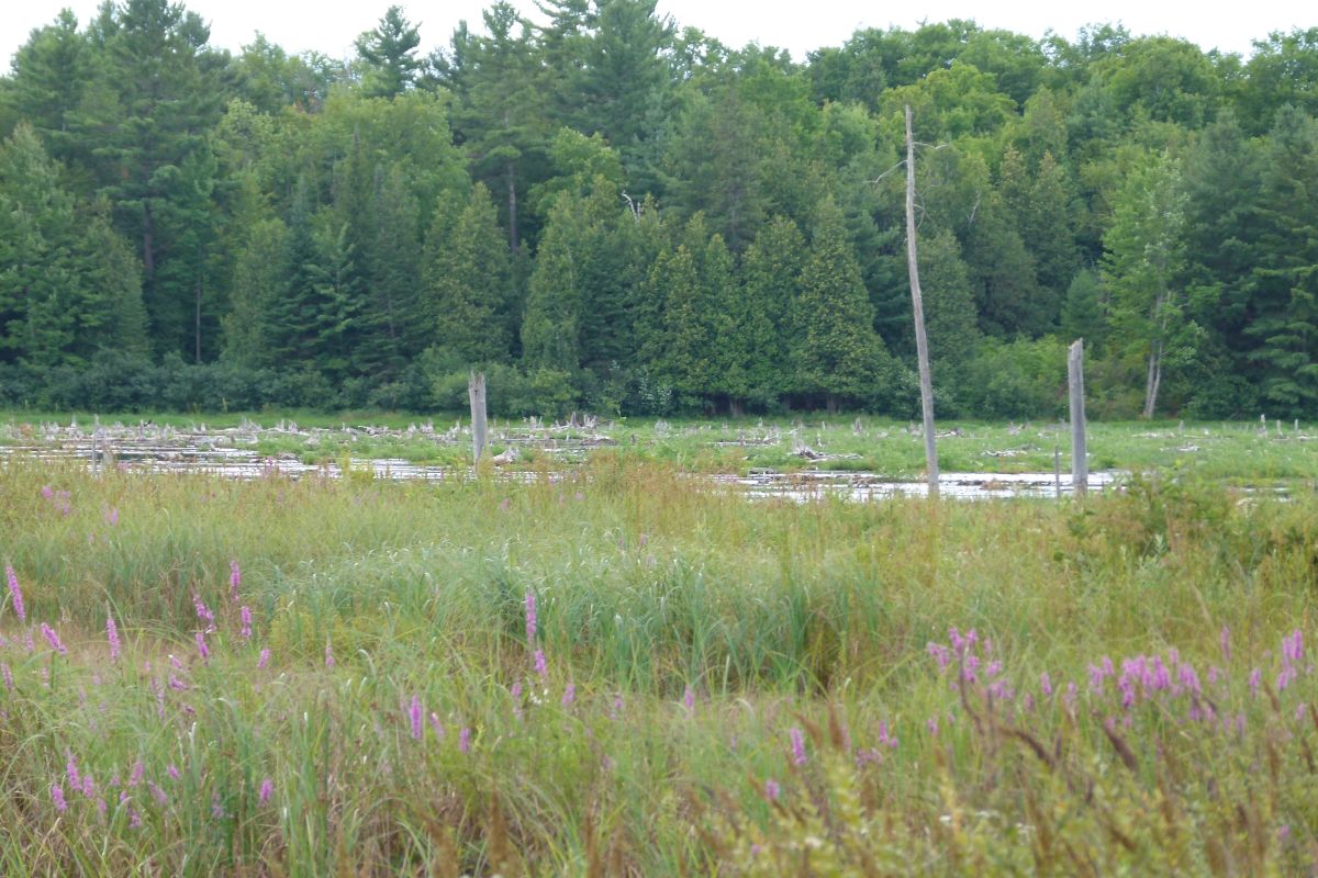
We spent the morning in the classroom and the afternoon in the field building a new trail, actually a re-route, in the South March Highlands.

Photos courtesy of David N of OMBA

In The Classroom


The Crew


Hiking In


The Route Is Flagged


Briefing From The Expert


Raking The Path


Bench Cut


Rock Work


The Finished Trail


Restoring The Old Trail


More photos of trail building school are available here.

Trail building school was sponsored by the Ottawa Mountain Bike Association (OMBA).

2010-08-02

At Least She Won't Be Sunburned When She Cracks Her Head Open

Anna Bebon, from Tommy & Lefebvre, is cool to go out
in the sun thanks to her UV-protected clothing by Lole.
Photograph by: Jana Chytilova, The Ottawa Citizen

As one who is a strong advocate of wearing bicycle helmets, seeing the apparent promotion of cycling without a helmet by a prominent local cycling store in what considers itself to be the city's newspaper of record is sure to catch my attention.

Perhaps upon further reflection and examination of the photo that comes with a photo credit, but looks like it should also have a Photoshop credit, I should not take the article, which appears to be an advertorial, too seriously. I mean what type of dock is that anyway, and why would anyone try to cycle on it.

Nevertheless, community leaders should be careful about what type of messages they are sending.

2009-11-11

2009-03-27

How To Not Close A Trail While Building A Highway Over It – The Vienna Experience

Another in my Austrian Reflections Series.

One of my pet peeves has been the closure of the Queensway pedestrian and bike underpass from the summer of 2007-2009 (don't know if it will open at all this summer) while construction is being carried out on the western portion of the Queensway near Kanata.

They do things differently in Austria. We were on mountain bikes along a trail that followed the Marchfeldkanal on the outskirts of Vienna and came upon the construction of a highway over the trail. As you can see from the photographs nobody felt that there was a need to close the trail and indeed children (with parents) and bikes were explicitly allowed on the trail.

The sign in German translates (according to Google)to “Forbidden to enter the site - Parents are responsible for their children”, which I understand to mean “stay on the trail”.

(click photos to enlarge)


These are some other photos from along the trail.