Showing posts with label mountain biking. Show all posts

2013-12-10

Reflections on My 2013 Biking Season

Now that I bike all year there is no end to the season but the putting away of the summer bikes and taking out of the winter bike marks the end of a season for me now. (Note: click on images in this blog post to enlarge them.)

Remembering Mario

As I reflect on the past season I feel a sense of guilt for feeling that I have had one of my best seasons yet, for how can I feel that way when we have lost our dear friend Mario in a tragic traffic incident.

I first met Mario about ten years ago in pre-OMBA (Ottawa Mountain Bike Association) days when MTB Kanata used to organize weeknight Jack Pine rides and weekend rides on what were then called the Kanata Lakes trails, which included the SMH (South March Highlands) trails on both sides of the Terry Fox Drive extension (which didn't exist then) through the forest.

One of my first memories is a road trip to CFMBA (Charlottenburgh Forest Mountain Bike Area ) near Cornwall. During the ride Mario noticed some issues with the trails, so of course, being Mario, he was back again for several weekends doing trail work.

Back in those days MTB Kanata used to sponsor several teams in the Tour Nortel (now CN Cycle for CHEO) and of course Mario was always a big supporter. Here is an image from the MTB Kanata newsletter of one of the few times Mario has actually “gone public” about what he has done. You can really tell he loved riding that bike.

One of my first memories of Mario's patience was a group ride on Outback where he was riding sweep. I remember finding it very challenging but he kept encouraging me even as we kept falling farther behind everyone else. Finally after taking a bit of a secret shortcut that he knew about near the end we finished about an hour, or maybe much more, after everyone else. Rather than being upset with me for holding him back Mario was more happy that I had accomplished the challenge.

And of course Mario was not a fair weather rider – he rode all seasons and loved his winter riding, he even perfected the making of spiked tires for winter riding, which, of course he had to share with everyone else on the OMBA forums.

When I started to volunteer for trail days for a couple of seasons Mario was always one of the regulars and if he wasn't there it was probably because he was helping somebody else with something.

One of my best biking seasons ever was the season that Mario was leading Group D on the Thursday Night Rides. You could not find a better person to lead a group of struggling beginners on the trails and he always tried to provide variety in the trails. As well as the usual SMH trails he would take us on the old Kanata Lakes Trails including the old Lost and Found Trails behind the GFR parking lot and the trails on the other side of GFR. One of his favourite things to point out was the H-tree, a tree along the trail that had grown in the shape of an H. (I have to go and find that tree now). I always loved that about Mario because that is the sort of thing that I would notice and it just re-emphasized that for Mario, like many of us, mountain biking is not the macho stereotype that is all about mindlessly ripping around on your bike, but it is just as much about being in the forest with nature.

The last time I saw Mario was at this year's Take a Kid Mountain Biking Day where our two groups kept leap frogging each other, even though I supposedly had the slower group. He had a couple of slower riders that he thought might fit in better with our group and asked me if I would take them, and of course I said yes. But, being Mario he didn't want to single them out so he asked everyone to express how tired out there were in a number between 1 and 10 and then suggested those that said 5 or less join my group. But nobody wanted to leave Mario's group and that was fine with him, and fortuitous for me as we kept leap frogging and I got to see Mario more often that day than I otherwise would, short little meetings on the trail that I will cherish forever.

Mario is remembered fondly by the Ottawa Mountain Biking Association and Trips For Kids Ottawa.

Mario would want us all to think positively, particularly about mountain biking and cycling that he loved so much, and he would want us to get out and ride as much as possible.

Statistical Overview

AS OF DECEMBER 7, 2013
TOTAL KM         HOURS         MTB KM         HOURS         HYB KM         HOURS         WB KM         HOURS
4944.75               317.58           860.75             75.63           3244.70           188.27          839.30           53.68

So what do the numbers say about this year's season. The first thing we notice is an increase in total number of kilometres over time, a new record each year, 4451 for 2011, 4754 for 2012 and already passed that on Nov 21, 2013 at 4767, and 4945 on December 7, 2013, well on track for a over 5000 km for the year.

It would be nice to think I am doing that much more biking but the increasing hours is not as great, going from 290 in 2011 to 318 by December 7, 2013. What we also see is a shift from mountain biking hours to hybrid hours, in 2011, 100 vs 162 and in 2013 so far, 76 vs 188. Winter bike hours went from 28 in 2011 to 54 so far this year.

Average speed this season on the mountain bike was approximately 11.3 km/hr, while it was 17.25 km/hr on the hybrid and 15.5 km/hr on the winter bike.

So for various reasons, trail and weather conditions and the fact that I am beginning to really enjoy the long hybrid rides, I am putting more hours on the hybrid, increasing my distance at a faster rate than the same hours on the mountain bike. The number of hours on the winter bike is primarily determined by when the City decides to start and stop dumping salt on the roads and paths.

CN Cycle for CHEO

The CN Cycle for CHEO is the first “event” of the new cycling season. The winter bikes go away at the end of March when the snow and ice are off the roads and paths and while the trails are drying out it is a month of “training” on the hybrid for the CN Cycle for CHEO (previously Tour Nortel) at the beginning of May. I have been participating in this fund raising ride for the Children's Hospital of Eastern Ontario for about 10 years. This year my daughter Jasmine joined me in doing the 70 km route at a pace of about 21.5 km/hr (75.5 km at 19.5 km/hr, if you include to and from the parking lot.). During our training Jasmine was a bit slower than my pace so I let her lead hoping to do a pace of about 18 km/hr, but she led us at a pace of almost 21.5 km/hr, my best pace yet. We both managed to make the 500 Club raising over $500 each.

Mapping Project

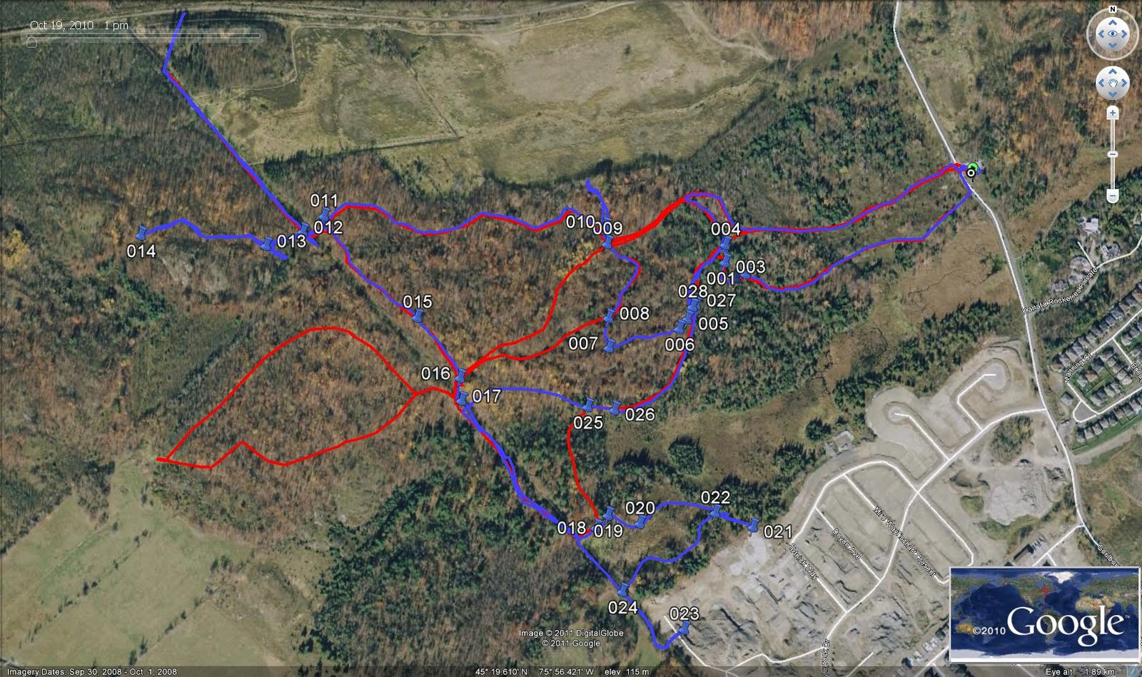
This season I continued my project to map the Greenbelt trails and finished mapping the western Greenbelt trails with the NCC Trail 10 trail system near Shirleys Bay.

All of the maps from my project are included on the Backroad Mapbooks Ontario GPS Map and when the next version comes out in the spring all my western Greenbelt trail maps, including the NCC Trail 10 system will be included.

Also during this season I mapped the trails adjacent to the Jackson Trails community in Stittsville, what appears to be an unofficial trail system with an uncertain future.

Also, on a day when I was looking for someplace new to ride I mapped most of the pathways in Stittsville, which I just realized I have not posted yet, so here is the overview map and watch for more detailed maps to be posted in the Hybrid Routes section of my Richard's GPS Trail Maps website in the, hopefully near, future.

Tuesday Night Rides

While, for various reasons I may put more kilometres on my hydrid, the high point of my biking week are the Tuesday Night Rides, also known as TNRs (® Andy AKA FaustCan).

The TNRs are intended to supplement the OMBA Thursday night rides in the South March Highlands but on the easier and more varied Greenbelt Trails. All riders from beginner to advanced are welcome and encouraged to participate. The trails we ride range from easy to intermediate technical.

The history of the TNRs goes back to the MTBKanata Jack Pine rides, and after those faded out, the MTBK Nora's No-Drop rides that I usually led.

The TNRs are a casual and fun experience with a great group of riders, usually led by myself or my co-leader Andy, who, if not kept in check will lead us off onto Untrails. We are always looking for new people to join the group and add to the fun.

To find out when and where the next TNR is just check the OMBA Ride and Event Calendar.

My daughter Jasmine usually joins us on the TNRs and next year my other daughter Maggie, and my wife Christine, might be joining us. I am looking forward to that.

Take A Kid Mountain Biking Day

My last bike event of the year is Take a Kid Mountain Biking Day where the the whole mountain biking community comes together to help Trips for Kids Ottawa get kids out of the house and away from the video games and into the bush to enjoy mountain biking, exercise and nature. My daughter Jasmine and I both volunteer to lead groups on the trails for this big event.

Below is Mario leading his group onto the trails at this event that he loved so much.

Winter Biking

I first started winter biking in December 2009 on a cheap $100 Supercyle, with studded tires that cost more than the bike, but I enjoyed it so much that when that bike died I replaced it in October 2011 with a used but better winter bike from Cycle Salvation. Later that season in February 2012, I modified itto make it more like a hybrid riding stance. And before the beginning of this season I added a panier rack and replaced the seat with a more comfortable one. The plan was to replace the chain and cassette at the end of this season but on my first ride I notice considerable chain slippage when I tried riding on trails or whenever I had to power pedal, such as going up hard hills. So it was back in to Eric at Phat Moose Cycles to get the chain and cassette replaced and now it is running like new. This is the winter bike in it's current incarnation.

The key to winter biking is keeping warm and I use the dressing in layers technique that I use for cross-country skiing and snowshoeing for my winter biking and wear my winter hiking boots instead of my biking shoes,.Winter biking has it's limitations but it does allow me to keep biking regularly throughout the winter.

Because many of the pathways are not cleared at all and others do not get cleared quickly, most of my biking is on the local community roadways, and again, because side streets are not always cleared quickly I have a number of regular routes that involve the collector streets in Bridlewood and Glen Cairn. However, I will sometimes go farther afield such as down Terry Fox Drive to Second Line and back via Old Crap Road, Huntmar Drive and Fernbank Road. Of course I have the advantage as a recreational cyclist rather than commuter to not have to be on the roads during rush hour.

Cycling advocacy

I have also used this blog and my Twitter feed to advocate for cycling issues.

In June I raised the issue of why the Prince of Wales Bridge isn't a bikeway and proposed a relatively inexpensive way to make it happen quickly. Since then the idea has been included in the City's Transportation Master Plan but as a much more expensive project in the distant future.


Photo Source

In July I blogged about Kanata's Secret Segregated Bike Lane, what appeared to be a low cost way to create a segregated bike, lane only to discover it was actually an “at-grade asphalt sidewalk“.

Perhaps my most important cycling blog post of the year was in August when, following a Twitter exchange, I posted Thoughts on Taking The Lane where I outlined the legal justification for cyclists taking the lane and stated:

While I am not one of those “vehicular cyclists”, that oppose cycling infrastructure because they think that the best place for all cyclists is on the roads competing for space with car drivers, I do believe that cyclists have a right to be able to ride on the roads safely. I also agree with the City of Ottawa when they tell cyclists “never compromise your safety for the convenience of a motorist”.

One of the most important ways that cyclists can ensure their safety on the roads is by taking the lane (riding in the middle of the lane of traffic) when appropriate and necessary

I also wrote a blog post in June relating to a proposal to widen roads through the Greenbelt to save commuters a few minutes in traffic during rush hour where I pointed out that:

Along this route proposed for widening there are two NCC parking lots, P6 and P11 with trail systems on both sides where crossing from one side to the other is already very difficult and dangerous. If any widening of these roads is allowed the NCC must insist that it include a solution that provides safe passage between the trail systems on both sides of the roads at the locations of those parking lots.

Conclusion

My life is good now and I am enjoying my retirement and cycling, especially mountain biking, is a very big part of that, thanks in large part to the friendly welcoming nature of the Ottawa mountain biking community. I enjoy cycling all year round but am especially looking forward to the next mountain biking season and the return of the Tuesday Night Rides.

2012-09-16

The Lime Kiln Technical Trail Will Never Be The Same

Today we finally had the opportunity to hike the Lime Kiln Technical Trail for the first time since the Lime Kiln area fire in the Stony Swamp Conservation Area.

(click on map to enlarge)

Things are looking pretty good for the first part of the trail, although you start to see larger and larger signs of fire as you look alongside the trail and then you are in the middle of the Fire Zone. At that point on the map you can see the hike diverging somewhat from the trail as we tried to follow the trail on the GPS and keep watch for the silver Rideau Trail triangles (silver because in most cases the blue paint was removed due to the heat of the fire). Most of the trail within the Fire Zone was unrecognizable although there were a few recognizable trail features along the route we followed.

The fire zone ended shortly before one of the fire roads crossed the trail. At that point the trail continues on the other side of the fire road but due to all the debris pushed up alongside the road we were unable to follow the trail. Knowing it reconnected further along the Fire Road we continued following the road, intending to follow it back from the other end, but when we reached that location we again had the problem of the piled up debris hiding the entrance into the trail, so we ended up missing about 200 metres of trail. After that the Fire Road wiped out most of the trail except for a short portion that ran just alongside it just before the Lime Kiln Bridge.

My guess would be, taking into account the first section of trail, and the section we by-passed, plus the short section of trail at the end, that close to 50% of the trail might be intact in it's original condition. The other 50% will probably need extensive rehabilitation and some of the technical features might never be recovered.

My inclination, however, would be that it would be best to let the natural environment and vegetation recover on it's own before attempting to rebuild the trail. We did notice that there already appeared to be some new growth within the fire zone and on the fire roads. At the appropriate time I would hope that the National Capital Commission (NCC) would consult with all trail users, including mountain bikers, in developing a trail rehabilitation plan.


(select 720p to view in high definition and full screen to view full screen)

2012-04-29

South March Highlands Mountain Bikers - Unlikely Trail Heroes

Unlikely, because more often than not the stereotypical view of mountain bikers is more likely to be as trail villains rather than trail heroes.

First, we have the well meaning but uninformed view of many who call themselves environmentalists that mountain biking damages trails, when the vast majority of the research indicates the impact is similar to hiking.

Then, we have perceived concerns of hikers envisioning people on scary looking full suspension mountain bikes, ignoring everyone else, speeding downhill towards them, when the reality is that mountain biking is not the Tour De France and mountain bikers on technical singletrack are usually not riding at racing speeds, primarily for their own safety.

And then we do have places where rogue mountain bikers rule and have little regard for other trail users or responsible trail use, but these are the real exceptions, even if they appear to be the stereotypical rule.

In the South March Highlands the mountain bikers are not seen as villains. This is partly due to a co-operative landowner, the City of Ottawa, and an open-minded and educated environmental community led by the South March Highlands Coalition.

However it is mostly because of the mountain bikers themselves and the leadership provided by the Ottawa Mountain Bike Association (OMBA).

The mountain bikers in the South March Highlands have established a reputation for not only be respectful, courteous and friendly to other trail users but are respected and appreciated by them for the literally thousands of hours of work put into developing and maintaining a sustainable trail system that can be enjoyed by all trail users.

The mountain bikers started riding on existing trails, created by hikers, cross-country skiers and even dog-sledders and built on it, creating a sustainable trail system based on the IMBA stacked loop model where the further you get from the trailhead the more rugged and difficult the trails become. This is a model that serves both beginner and advanced hikers and mountain bikers well.

The mountain bikers put in literally thousands of hours of work on trail building and maintenance creating a sustainable trail system that avoids muddy areas and provides for proper drainage and erosion protection. As well as building a system that is less susceptible to rain damage they also educate and encourage riders not to ride in the mud, and when it is necessary to follow the rule of sticking to the middle of the trail to avoid trail widening.

But they have not done this in isolation from the community and other trail users but have worked with them and the landowner, the City of Ottawa, to develop a management plan for the South March Highlands Conservation Forest and the trail system and are about to sign a joint stewardship agreement with they City to manage the trail system.

They have already created a new map of the trail system and are just beginning to install comprehensive trail signs linked to it in a project where materials are funded by the City and volunteer labour provided by OMBA members. This is a project that will be appreciated by the whole community as this is a near wilderness trail system where people have often become lost on the trails.

Indeed, if you ask just about anyone you see on the trails you will find that in the South March Highlands the mountain bikers are not the villains, but rather the heroes that do so much to make the trails a wonderful experience for everyone that uses them.

2012-04-28

Reflections

This has probably been the longest I have gone between blog posts, despite my best intentions, but as I said I have not abandoned you. I have simply been busy with other things mostly related to mapping and biking and the South Match Highlands struggle.

But I have also been using Twitter a lot to express my political and social opinions so if you see nothing new in this space look to the right for my Twitter Feed or go directly to it here.

2011-12-19

2011-10-30

Cycling and Mountain Biking Season in Review

I know it's not over yet, and with the winter bike it is never over, but I feel it's been a great season so far and now is as good a time as ever to put my thoughts down in print.

The time will come soon enough when the trails are no longer rideable and the salt is being dumped on the roads and paths, that I will have to bring out the winter bike. Last year my last mountain bike ride was on November 11th in the South March Highlands and my last hybrid ride on November 22nd, my first winter bike ride was a week later on November 29.

Last years total was 3175 km, 475 on the MTB and 2700 on the hybrid and winter bike from January to December. So far this year, since January, I have done 2630 km, 930 on the MTB, 1410 on the hybrid and 290 on the winter bike.

Will I actually beat those numbers this year. In a sense, I probably already have when you consider that I have almost doubled the distance on the MTB which is considerably more intense riding than hybrid riding. Of course, last year I was off the MTB for 9 weeks and off both bikes for 6 weeks, after the incident (broken arm).

But I am hoping, considering how dry the trails have been this year and still seem to be, to see an extended season before the fall rainfall and slow drying effect of the fall weather come into play.

The season started well with putting the winter bike away at the beginning of April and about a month of hybrid riding to prepare for the CN Cycle for CHEO. I really enjoyed the improved route this year, even if there was more climbing. They certainly improved the way they handled the route across the downtown core. Unfortunately the organized mountain biking participation has been steadily declining since we had 5 teams raising $15,000 at the peak of MTB Kanata. I may simply ride independently next year.

My first MTB ride this season, on the GFR trails and Trillium Woods Trail, was the day before the first OMBA South March Highlands group ride on May 12. After missing most of the SMH rides last year due to the incident I got off to a good start this year, enjoying the Thursday night rides up until they became night rides and I decided to restrict my night riding to the Greenbelt.

But perhaps what I am most pleased about this season has been the enthusiastic participation in the Tuesday Night Greenbelt Rides, and no broken bones yet. We have a great regular group of riders, sometimes joined by others, that enjoy the casual pace of just tooling around the flowy Greenbelt trails, with some technical sections thrown in for added fun. I finally got my new batteries for my Magicshine lights, which I had hardly used before. What an improvement over my old NiteHawk lights, for the same (aprox $100) price. It is a real joy to ride with these and I am really finding the continuing night riding to be a great experience.

The Greenbelt rides have also led me to find a new riding buddy, that shares my local trails and rides at about my same pace and technical ability, so riding with him has been great fun. I have to get him to expand his riding preferences though - get him out to SMH and into distance riding the on paths and roads.


I'm going to have to say, what some in OMBA might consider to be blasphemy, but I also prefer the Greenbelt to SMH for sheer enjoyment, probably because I can ride to the trails from my front door.

I believe I have only been to one OMBA SMH trail day this year but I have spent some time working on the Greenbelt trails clearing dead-fall. What a season it has been in both SMH and the Greenbelt for storms bring trees down over the trails. I have plans for early next season to get into Middle Earth on foot and clear out what is certain to be a lot of dead-fall in there and to do some discreet trail work near Old Quarry to connect up two sections of trails that are calling out to be connected and clear another section of trail that is difficult to follow, especially at night. And then some new trails to take the Tuesday Night group out on.

A report on riding would not be complete without talking about my Richard's GPS Trail Maps project to map all the western Greenbelt trails as well as other trails. I never did get back to mapping the Bruce Pit Trails, as planned this summer, as I got sidetracked into unplanned mapping at SMH in response to the clear-cut of the Beaver Pond Forest trails and the impending development of the old Kanata Lakes Trails. I also was made aware of a neat little trail system by Lytle Park that has been added to the collection.

In regards to the GPS Maps project, about a year ago I was contacted by the people who produce the Backroad Mapbooks who wanted to use my trail maps in a new GPS map product for Garmin GPS units. The end result of that was that I agreed to let them use the GPS data with no conditions and they graciously provided me with a free copy of their Ontario GPS map product. I have only used it for about a week but I have to say that I am very impressed and a full review will appear soon on "Richard's GPS Trail Maps" site.

Had a really nice ride today on a nice cool afternoon. The next two weeks are still looking pretty good, especially both Tuesdays. See you on the trails.


Update (2011-11-10)

I just realized I had a formula error and my hybrid distance was incorrect.
My corrected totals as of today are:

Hybrid: 2632.20
Mountain Bike 1004.75
Winter Bike 287.50
TOTAL: 3924.45 Kilometres

2011-06-17

108 Kilometres and 5 Pounds Later (Ottawa River Pathways Hybrid Epic Ride)

Well it has actually been a few years since I have done an Epic (Over 100 kilometre) Hybrid Ride and I have been wanting to find out just how long a ride encompassing both the western and eastern Ottawa River pathways would be, having rode both separately.

Click on Map to Enlarge

One of the things keeping me from doing this sooner was the lack of proper connectiveness between the two sections, which I have written about previously.
East and West: Two Solitudes - The Problems With The Ottawa River Pathway

The Ottawa River Pathway Two Solitudes: PostScript
Starting in Bridlewood I took the Trans-Canada Trail through the Greenbelt joining the Ottawa River pathway at the Andy Haydon water park. The western pathway route is an enjoyable ride along the Ottawa River on paved pathways with the opportunity for pit stops to eat and drink at Britannia and Westboro beaches.

The connection to the eastern section was not as bad as I expected. After the killer hill up the cliff by the locks you just take Murray Street to Sussex Drive and continue to the Rockcliffe Parkway and onto the eastern pathways. So I was fine, but anyone who is intimidated by riding on major heavy traffic roadways could be intimidated and even a bit frightened, and our pathway system should not force cyclists into those situations.

Once I reached the Rockcliffe Parkway I was back onto paved pathways leading to the pathways along the river.

Click on Map to Enlarge

For the ride east I took the paved upper pathway along the Rockcliffe Parkway that goes past the Aviation Museum and then rejoins the path along the River.

Once you hit Orleans you follow the streets a bit past the Résidence Saint-Louis following the bike route signs and then take the Petrie Island Pathway that ends at Trim Road, but you can continue down Trim Road to the island. Most of the Petrie Island pathway is brand new pavement except for the last portion that is gravel. The pathway goes past a number of what appear to be mountain bike trails crossing over it, that I have yet to check out.

On the way back I kept to the pathway closest to the river, which is primarily a hard-packed gravel surface. Both pathways are enjoyable and scenic.

Casual cyclists should be aware that after you leave the river pathway, the path along the Rockcliffe parkway goes along a cliff and narrows for a portion and that can be a bit concerning but really is no great problem.

Getting from Sussex Drive back to the western pathway was another matter. I should have done better advance planning for the trip back and I ended up darting across the road where St. Patrick joins Murray Street during a break in traffic to get back to the path down the cliff. A better route would have been to continue along Sussex Drive to the other side of Murray Street and then walk the bike along the sidewalk to the path down the cliff.

Click on Map to Enlarge

The biggest concern of the ride was the heat and probably a sign that I picked the wrong day for an Epic Ride. I have done long rides (60-70 km) on hot days and I have done over 100 km rides before but combing both was probably a bad idea and after the 90 km mark I was starting to feel the effects of heat exhaustion, but I managed to make it home without collapsing.

One of the problems of the pathway system (besides the lack of washroom facilities, particularly in the early and late season) is the shortage of drinking water facilities. There are very few water fountains on the route and the few that are there require you to almost swallow the fixture to get a drink, making it impossible to use them to refill a water bottle.

I was able to buy water from a vending machine at the Rockcliffe Yacht Club though. The multitude of Private Property and Members Only signs kept me from even thinking about asking them to refill my water bottle with tap water, I felt fortunate that they let me use their vending machine.

But all being said it was a great experience and I would do it again on a cooler day.

Overall stats:

Total Distance: 108 km
Time Moving: 5 Hrs, 40 Min
Average Speed 19 km/hr
Maximum Speed 36.3 km/hr

Weight Lost During Trip: 5 pounds (but I regained about 3 pounds by next morning after rehydrating, etc.)

2011-05-27

Reflections on Mapping the South March Highlands Kanata Lakes Trails

For purposes of simplicity, although both trail systems are within the South March Highlands, I will refer to these trails, across from the Goulbourn Forced Road (GFR) parking lot, as the KL trails and the ones in the Conservation Forest as the SMH trails.

On Wednesday (May 25, 2011) I started my latest mapping project of what mountain bikers refer to as the Kanata Lakes trails, to distinguish them from the trails within the South March Highlands Conservation Forest. I do this either with a sense of history or a sense of optimism because these trails are located in Phase 7 of the KNL/Urbandale Destruction and are planned to be destroyed along with the forest and geology they are part of, to be replaced with yet another ticky tacky suburban subdivision.

Need I say one more time that losing this land and these trails will be a real tragedy, and indeed the Terry Fox Drive extension (routed over the least environmentally friendly route after public consultations indicated environmental factors should be the first priority in route selection) has already had a devastating effect on the natural and trail connectedness in the South March Highlands. Nevertheless as we fight to save what is left we should enjoy it for as long as we can and hopefully this trail map, when completed, will contribute to that.

As with any mapping exercise I start I quickly discover the trail system is more complicated than I thought and includes more trails than on any existing map. So this is going to take a few rides to complete. At the moment I have tracks from this ride (blue) and another from last summer (red) on the very preliminary map below.

click on image to enlarge

As there did not appear to be any visible trail left at the old Kizell Pond signpost, I thought I would go in from the "Race Track Entrance" (that is not the entrance right across from the parking lot, but a bit south of it where you go "through" a couple of rocks) and see if I could work my way out to the signpost.

I never did get there but I did follow the hydro cut all the way to it's southeast end and discovered it ends in the Kizell Pond Subdivision. In the process I discovered a little loop around part of Kizell Pond, that might provide a pleasant route for short nature hikes with easy access. That was the first time I followed the hydro cut all the way to that end.

I also followed the hydro cut all the way to the northwest end where it ends at the Terry Fox Drive extension close to where it used to cross the rail line. As there was construction going on, and operating equipment right in my route to the other side, I was not able to confirm if you can access the other side. Depending on the gulley along the rail line you should be able to cross Terry Fox Drive at the rail line (traffic permitting) and connect to the rest of the trails.

The other interesting thing I discovered was another open section of trail (blue) west of the hydro cut on "The Dark Side", in addition to the section (red) I discovered open last summer. "The Dark Side" was private land that was fenced in and biking was prohibited on. Some of it is now city land but the status of these sections would require a very careful map comparison/overlay to determine. Both of these sections end at the new Terry Fox Drive extension.

The rest of my mapping experience consisted of following the usual KL trails including one offshoot that leads to a big open field where you can see the rail line across on the other side. If you follow the preliminary map above with these descriptions you should be able to see where much of what I am talking about is.

So why is this land and these trails so important. Very briefly, the South March Highlands is the most bio-diverse area in Ottawa and we are very fortunate to have such an area within our city and so close to the urban area. But, being surrounded by urban land puts its ecological integrity under great stress and if we continue to develop important pieces of it not only do we reduce its size but we increase the outside stresses on the land. We are close to the point of it's losing it's ecological integrity.

But this post is about the trail system and the KL trails have their own character distinct from the SMH trails. For mountain biking much of these trails are at an easier level and more open to riding by beginners. The terrain differences also make these trails much better suited to cross-country skiing than the SMH trails, which are better suited to snowshoeing. The two trail systems complement each other very well and are part of one interconnected ecological system, even with Terry Fox Drive running through the heart of them.

There is one distinct difference between the two systems. The KL trails are older and most were built by hikers and cross-country skiers while many of the SMH trails were by built by mountain bikers and are being maintained by them. It is very obvious that the SMH trails are much more sustainable than the KL trails. If we are successful in saving the KL trails there will need to be a review of the trails, which can probably be done as part of the City of Ottawa - OMBA (Ottawa Mountain Bike Association) joint stewardship agreement that is expected to be signed soon. Much work will need to be done to bring them up to OMBA standards. possibly including rerouting or closing some sections of trail.

But for now I hope to just finish mapping the trails so that we know what is there and can all enjoy the wonderful experience of being in this forest that we all hope to enjoy forever.

Now if we could just get the decision makers to spend a day in this wonderful forest.

2010-10-25

Mountain Biking and Saving the South March Highlands

Click On Images To Enlarge

The Ottawa mountain biking community in recent years has been focused on the South March Highlands Conservation Forest accepting that the rest of the South March Highlands/Kanata Lakes trails will be lost to inevitable urban development.

Personally I am starting to become very hopeful that that will not be so and that at least some, if not all, of the remaining South March Highlands lands and trails will be saved from development. This will provide the potential for the South March Highlands to become a real family destination for mountain biking with trails ranging from true beginner (Greenbelt type) level trails to the advanced trails in the Outback system.

Just last week I rode some of the old "Kanata Lakes" trails between Goulbourn Forced Road and the Hydro Cut and it was quite enjoyable. The addition of these trails back into the system would increase the intermediate (Group D type) level trails in the system.

But where I see real potential is in the land north of the existing Conservation Forest that already has a trail on it that connects to the trails within the existing Conservation Forest and provides a trail all around Heron Pond. This land is currently privately owned but zoned Environmental Protection. The potential I see there is to purposefully build a new sustainable trail network on the land further north where true beginner level trails could be built so that whole families, from Ottawa and beyond could visit, Family members could ride the trails that suit their skill level all from one central trailhead, where toilet facilities could be provided and perhaps a picnic area for families to meet up together mid day.

The same trails that form the basis for a beginner trail system could be used for a flowy race course where races could be held to further promote the South March Highlands as a mountain biking destination.

As is the current practice all these trails would be shared trails open to everyone. The only exception being the race course while actual races were being held.

The current City Council takes the first step to save all of the South March Highlands at one of it's last meetings in mid November. Urge your current councillor to support the Wilkinson-Doucet motion that starts the process of saving all of the South March Highlands. Let us all do what we can to save the South March Highlands from further urban development.

2010-09-28

East and West: Two Solitudes - The Problems With The Ottawa River Pathway

(Click On Maps To Enlarge)

The really nice thing about Ottawa is that so much of the Ottawa River shoreline is in public hands and includes shared scenic recreational pathways/bike paths. In the past few weeks I have rode on the eastern and western portions of the Ottawa River pathway and made some observations. The first one being:


It is often said of Canada, that it consists of two solitudes, English Canada and French Canada. When it comes to the Ottawa River Pathway the solitudes are East and West. The connections between Ontario and Quebec are actually quite good, however the East and West sections of the Ottawa River Pathway are separated from each other by sometimes dangerous roadways. I did not even try to follow the roadway from the east to west on my last ride because it started along a very narrow and winding under construction section of road.

However if you examine the map above you will see that there is not much development along the riverfront between the two sections of the Ottawa River Pathway, and I believe most of what development there is, are federal institutions. One of the problems with the National Capital's very good system of pathways is the lack of key interconnections. I believe this missing link to be one of the most important missing connections and connecting the two sections properly, avoiding roadways, should be given the highest priority.

I also see a problem with the western section of the Ottawa River Pathway:


The Ottawa River Pathway ends at the Andrew Haydon Park water park, although two separate pathways continue, one through parkland (Andrew Haydon Park and Dick Bell Park) and one along Carling Avenue.

Unlike all other pathways that I know of in the National Capital Region, the one through this parkland is not a shared pathway and bicycling is not allowed on it. The only reason I can think of for this anomaly is that it goes back to when those parks were in Nepean and different rules were applied. Indeed the section immediately east of the water park going go Britannia Park has as much, if not more, pedestrian traffic than the section that goes through Andrew Haydon Park and bicyclists and pedestrians manage to share the pathway with no problem. As well since there is an alternative faster and shorter route along Carling Avenue, commuter cyclists in a hurry would opt for that route leaving the route through the parkland for those wanting a casual ride through parkland avoiding the traffic noise of Carling Avenue.

It is time to move on and apply the same rules to this pathway as all other pathways in the National Capital Region.

After Dick Bell Park the pathway continues along Carling Avenue as that is where the publicly owned land ends, at least until we get to Shirley's Bay.

I also have an observation to make about the eastern end of the Ottawa River Pathway:


I discovered that there is another very pleasant gravel pathway a short distance from the eastern end of the Ottawa River Pathway. The pathway starts alongside Hiawatha Park Road, not far from the Bruyère Continuing Care Saint-Louis Residence, and goes all the way to Trim Road. One interesting thing about this pathway is that a group of what appear to be hiking and/or single track mountain bike trails intersect with it and run alongside a portion of the pathway.

I believe it would be very useful to have some signage at the eastern end of the Ottawa River Pathway directing people to this, as far as I know, unnamed pathway.

The Ottawa River Pathway is a very important part of the National Capital Region shared pathway system and very enjoyable to cycle on. With some improvements it could be a real gem, the most important being connecting the east and west sections safely so that they are no longer two solitudes.

See also: Ottawa River Pathway Two Solitudes: PostScript

2010-09-21

Trail Building School in the South March Highlands

This past weekend I had the good fortune to attend a trail building school held by the people who invented sustainable trail building and literally wrote the books on it, the International Mountain Bicycling Association's IMBA Canada Trail Care Crew:

Supported by Parks Canada and the Trans Canada Trail (TCT) and directed by the International Mountain Bicycling Association Canada (IMBA Canada), the IMBA Canada Trail Care Crew works with IMBA Canada-affiliated mountain bike clubs, TCT Provincial and Territorial organizations, Parks Canada and other trail user groups. Its mandate is to build new trails, maintain and restore existing trails, participate in solving trail management challenges, and to promote trails in order to improve trail conditions and trail experiences for everyone.

The IMBA Canada Trail Crew is a dynamic two-person team of professional trail builders that will travel throughout Canada year-round.

The work that the crew will do will benefit all types of trail users including hikers, horseback riders, mountain bikers, cross country skiers, snowshoers, bird watchers, and all other outdoor opportunities that use trails.

Source: Parks Canada website
Sustainable trail building is not just about mountain biking, and indeed most MTB trails are shared trails and IMBA has been working with other trail users in providing education and has trained people from the National Capital Commission (NCC) and Parks Canada in sustainable trail building methods. Parks Canada is currently revising their trail building manuals to reflect IMBA guidelines, and the NCC seems to be going through a slow shift in their attitude to mountain biking.

The first thing we learned at trail building school is that water runs downhill, well actually that was the second thing we learned. The first thing we learned was that planning is the most important part of trail building and should have the most time devoted to it. Key points are that all trail users need to be considered in planning a trail and that route design can be key in making a trail sustainable.

This is where the water runs downhill part comes in. One of the biggest factors in sustainable trail building is avoiding erosion so that designing a trail so that water runs off it rather than along it is key, and much of what we learned had to do with the degree of incline and slope of a trail. The bench cut method is one way of doing that. Some of the things we learned are described here.

Other factors in designing trails include keeping them away from fragile habitats of endangered species, the Blandings Turtle was mentioned, indicating that the Trail Care Crew was familiar with the SMH situation.

During the trail building school we got to meet many new people and learn a lot of new information, some of it not directly related to trail building techniques, such as the fact that OMBA has been given permission by the City to post signs on the SMH trails to help bikers and hikers know where they are and find their way out. I expect the signs will be in place by next spring. I also learned that the City of Ottawa's draft trail plan for the South March Highlands, with its inappropriate trail closures and denaturalization of trails, is apparently dead. Hopefully it will be back to the drawing board with proper consultations with the public and experts in trail design and building.

We spent the morning in the classroom and the afternoon in the field building a new trail, actually a re-route, in the South March Highlands.

Photos courtesy of David N of OMBA

In The Classroom


The Crew


Hiking In


The Route Is Flagged


Briefing From The Expert


Raking The Path


Bench Cut


Rock Work


The Finished Trail


Restoring The Old Trail


More photos of trail building school are available here.

Trail building school was sponsored by the Ottawa Mountain Bike Association (OMBA).

2010-06-15

the5thColumnist Is a Twit

Yes, I've decided to become a twit, or a twitterer or whatever you call one who tweets. I've been watching Twitter for awhile and decided to try it. Like most forms of Internet technology I think it is misused more than it is well used, particularly as another way for celebrities to say "I'm more popular than everyone else - I have more friends without lives of their own following me than you do."

One of the things I think Twitter is really useful for for is live blogging - allowing 'citizen journalists to cover events live just like the mainstream media as well as for disseminating in formation on political/social/environmental campaigns and events.

I will probably be using it primarily to let followers know when I have updated either of my blogs - The Fifth Column or Richard' GPS Trail Maps and occasionally to draw followers attention to other blog posts that I am really impressed with.

So why now. Well I just broke my arm a week ago in a mountain biking accident and will be unable to bike for 6 to 8 weeks and somewhat limited in what I can do with just one useful arm and hand so I'm probably going to be spending more time at the computer for awhile.

You can find me on Twitter at Richard W. Woodley (the5thColumnist) on Twitter. You do not have to have a Twitter account to access this page and read my twits.

2010-05-18

Reflections on Murdered Trees

During Sunday's OMBA trail day there was some discussion about using natural materials, and particularly wood from around the trails in the South March Highlands, for trail projects such as bridges. I raised the issue that there may be a perception problem even if you use dead trees or trees that have come down during storms. Indeed there have been complaints of mountain bikers cutting down trees, though none of them have been confirmed and no evidence can be found of it happening. I suspect they may simply be based on people seeing trail crews going in with saws to cut down trees that have fallen over the trails during storms.

Then, yesterday, as I was riding along M-line, I remembered my earlier nature hike along the Terry Fox Drive Extension work with members of the Coalition to Save the South March Highlands where we saw the huge trees that had been cut down for the roadway, not to mention the cutting down of what may have been the oldest tree in Ottawa, an over 200 year old Maple. It seems that in Ottawa the City will spend hundreds of thousand in court costs to fight residents who want to remove trees that are damaging their foundations but when it comes to really significant trees and forests it gives the orders to clear cut them.

None of that can be undone but it got me thinking that maybe some of what has been cut can be salvaged for use in what remains of the conservation area, perhaps for trail work or for other uses.

If there is anything left of the over 200 year old Maple it should be preserved for use in a memorial to the City's greed (for free federal money) and willful environmental blindness. I would love to see the stump cut level with the roadway so drivers actually had to drive over the top of it to be reminded every time they drive the road of what was sacrificed for their precious highway.

Unless of course, the unthinkable happens, and they stop the madness.

2010-05-12

Submission to NCC CEO Marie Lemay on Mountain Biking and the South March Highlands

This is also being submitted directly to Marie Lemay via e-mail

To: Marie Lemay
Chief Executive Officer
National Capital Commission (NCC)

From: Richard W. Woodley
environmentalist, hiker, mountain biker, snowshoer, cross country skier, kayaker

I am writing to you about two subjects of concern to myself and many other residents of the National Capital Region. While they may not seem related at first you will see that indeed they are.

The most critical issue I am writing about at this time is saving the South March Highlands from development. The other related issue is the NCC's attitude to mountain biking.

Myself and many other cyclists in Ottawa were very pleased to read of your vision for cycling in the nation's capital as reported in the Ottawa Citizen:
OTTAWA — The NCC wants to inspire Canadians about the capital region by becoming a model for transportation, combining a network of cycling lanes and pathways across the downtown cores of Ottawa and Gatineau.

Marie Lemay says she hopes that “people would turn to us and say: How is it done in Ottawa? How is it done in our capital?”
...

Although the NCC has maintained recreational biking paths in the national capital region for 40 years, Lemay said she realized last summer the importance of moving beyond those paths to create a safe, integrated network of cycling lanes and pathways across the downtown cores of Ottawa and Gatineau.
As well as being a cyclist who rides the bike paths and roads in the National Capital Region, I am also a mountain biker. The National Capital Region, with it's Greenbelt and Gatineau Park, as well as the South March Highlands, has the potential, and the geography, to be a haven for mountain biking, and mountain biking should be included in any vision for cycling in the capital.

Mountain Biking and the NCC

Unfortunately the NCC has a very poor reputation with mountain bikers, largely due to their lack of understanding of the sport, and policies based on prejudice and misinformation, as I have written previously about mountain biking in the Gatineau Park in The Fifth Column:
The NCC, in it’s wisdom, has decided that mountain bikers should be second class citizens in the park. If they want to ride single track trails they are relegated to a small section of the park (Camp Fortune) run by a private operator where fees are charged. Meanwhile hikers and trail runners have free reign over all of the public trails in the park at no charge, including the wide trails designated for mountain biking.

I appreciate having the wide gravel trails to ride, they are fun, but mountain bikers, like serious hikers, love rough natural technical single track trails, which are a lot more environmentally friendly than widened gravel roads, which the NCC loves to build and call trails.

There are two arguments for keeping mountain bikers off single track trails - user conflicts and environmental damage. However, neither of these arguments holds up to scrutiny.

In various places, including the NCC’s own greenbelt (where bicycle use is against NCC regulations but the regulations are not enforced), hikers and bikers regularly share the trails with each other with few problems. I can personally attest to never having had a conflict with hikers on the greenbelt trails while riding them regularly (several times a week). I can also attest to hiking and mountain biking in the South March Highlands and always having other trail users treat me with respect, whether as a hiker or a biker.

As to the environmental impact, the overwhelming scientific evidence indicates that hikers and mountain bikers have equivalent impacts on trails. See, for example, the reviews done by the International Mountain Bicycling Association and the New Zealand Department of Conservation.

For more information on mountain biking see the International Mountain Bicycling Association (IMBA) website and the Ottawa Mountain Bike Association (OMBA) website.

...

The NCC has an opportunity to make the Gatineau Park an internationally acclaimed location for both road cycling and mountain biking. Let us see if they are up to the challenge.
I would also at this time like to reference my three submissions on Mountain Biking in the Greenbelt to the NCC's Greenbelt Review. They provide more details on how the NCC can make the National Capital Region a haven for mountain biking.

Why Mountain Biking Should Be Allowed on the Greenbelt Trails

Winter Trail Conflicts on the Greenbelt Trails

Old Quarry Youth Mountain Bike Skills Park

Saving the South March Highlands and the NCC

When I first moved to Ottawa I spent a lot of time in the Gatineau Park. However when we moved to Kanata we reduced considerably the time we spent in the park. Partly it was due to having the Greenbelt in our backyard but a large reason was because we had our own ecological jewel, our own Gatineau Park so to speak, in Kanata, in the form of the South March Highlands.

Now that jewel is threatened. While a portion of it has been purchased and protected by the City of Ottawa a large portion is slated for a housing development (KNL/Urbandale lands).

And the protected lands are going to be divided by a four lane highway, the Terry Fox Extension, using what has been described as the worst possible route from an environmental perspective. The City of Ottawa is rushing the project through even though the initial demographic projections for population and traffic have been considerably reduced (without even considering the now possibility that the KNL housing development may not proceed), and they are doing it by playing fast and loose with the environmental assessment process.

The reason for the fast tracking is free money provided as part of the federal government's economic stimulus plan. Now one might expect a government that claims to be fiscally responsible to attach conditions to it's funding requiring that the money be spent wisely and that the partners take the time to do things right. But apparently the only condition placed on the stimulus funding is that it be spent quickly.

So now we have a double threat - a housing development through an ecological jewel and a road being rushed through prematurely to serve that development.

Let us talk about the South March Highlands from an environmental perspective. The south March Highlands have been studied extensively by Dan Brunton who has authored many studies of the area, including:

Natural Environment Area boundary in South March Highlands Special Study Area: Final Report, June 2004

Natural environment assessment: South March Highlands Conservation Forest, May 2008

This is how Dan Brunton described the South March Highlands in his 2004 report:
3) OVERVIEW OF THE SPECIAL STUDY AREA (ADAPTED FROM BRUNTON 2000)

The Special Study Area is situated at the southern end of the Precambrian Shield bedrock outcrop known as the Carp Hills which extends from Kanata northwestward to the Ottawa River in the Galetta area. This wetland-rich landform is unique in the City of Ottawa, constituting a 'island' of rugged, heavily-glaciated, rocky, Gatineau Hills-like habitat on the otherwise ±level, sedimentary lowlands. The end result is a landscape with severely limited agricultural potential and substantial challenges to residential/ commercial development. It has remained largely undeveloped, constituting one of the largest areas of continuous natural landscape in the City. The more or less original natural state coupled with a uniquely complex geology has resulted in the southern portion of the Carp Hills (the South March Highlands) supporting a diverse and significant natural biodiversity including Provincially and Regionally significant features and habitats (Brunton 1992a; 1992b; 1997).

The South March Highlands incorporates a number of watercourses and their watershed areas. The SSA incorporates catchment areas for the Carp River, Shirley’s Brook and Watts Creek. Most of the drainage in the SSA is westward down the Hazeldean Escarpment slope and into the Carp River. The northeastern corner of the area drains eastward, however, flowing into the south branch of Shirleys Brook. So too does the Watts Creek headwaters which commence immediately west of the First Line Road ROW in the southern half of the area and flows easterly through Kanata (‘Kizell Drain’), eventually discharging into the Ottawa River (Dillon Consulting 2002). Numerous small and/ or intermittent drainage channels occur in the many depressions and ravines occurring in this rugged landscape, all other eventually reaching the Carp River system.

The SSA (Figure 1) is part of the South March Highlands natural area which, in various configurations, has been identified as a candidate Provincially Significant Area of Natural and Scientific Interest (ANSI) (Brunton 1995), a High Value Natural Environment System Strategy (NESS) natural area (Ottawa-Carleton 1997; Brunton 1997) and Natural Environment Area-A and Natural Environment Area B (Ottawa-Carleton 1999). The significance of this area is reflected in the purchase of over 225 ha of natural landscape north of the railway for long-term ecological protection purposes by the former Region in 2000 (Figure 9). This ‘Regional Conservation Land’ area was enlarged by the City of Ottawa through the purchase of an additional 20 ha of adjacent natural landscape in 2002.

The SSA supports a rich diversity of native plant and animal species typical of superior examples of their respective habitats within the South March Highlands (Brunton 1992a). Some of these species are found within the Highlands only in or immediately adjacent to the SSA (see section 4.1, Significant native species, below). The mature upland deciduous forest habitat in the northern half of the study area contributes the greatest number of these representative and locally unique species (Brunton 1992b).

The SSA contains an extensive complex of common and rare habitats demonstrating a high degree of ecological integrity. Over 80% of this area supports Regionally rare vegetation types (Geomatics International 1995). A number of the nesting bird species present here and in the adjacent forested landscape to the east breed successfully only in extensive woodlands (Brunton 1992b; Muncaster 2002c). Habitat fragmentation is rare here, with the First Line Road ROW providing the only physical interruption crossing the length of the SSA.

A high level of natural biodiversity is identified as an important contributor to the identification of a Provincially Significant natural area (Ontario 1997). The contribution of the SSA to the ecological integrity of the larger South March Highlands natural area is an important element of the latter area’s overall significance and conservation value.
The following is from Brunton's 2008 report, which discusses the impact of reducing the protected area of the South March Highlands to 35% of the original conservation area. Notice the use of terms like "ominously" and "disquieting".
6.1 SIGNIFICANCE AND SENSITIVITY CONCLUSIONS

Remarkably, much of the native biodiversity identified in the 1991 - 1992 South March
Highlands inventories is retained within the 35% of the former South March Highlands conservation area presently designated as Conservation Forest. Approximately 94% of the native vascular plants of the larger area, for example, are (or were) found here. The fragility of this representation is underscored, however, by the wide variety and serious nature of present and increasing environmental stresses described in section 5. Impacts and ecological challenges (above).

It also bears repeating that the 41 Regionally Significant plant species now known from the Conservation Forest represent only 85% of the 48 such taxa known from the larger former conservation area and include none of the known Provincially Significant species of the South March Highlands. More ominously, perhaps, is the fact that 13 (27%) of Regionally Significant taxa, are either known or suspected to have been extirpated. Similarly, one known SARA-scheduled (Threatened) animal species, Blandings Turtle, has only been observed at the very western and northern edges of the Conservation Forest while another SARA-scheduled (Threatened) species, Golden-winged Warbler occurs at a site adjacent to a proposed arterial roadway corridor.

This evidently lower level of sustainability for the most vulnerable components of the native biodiversity of the Conservation Forest is particularly disquieting when future ecological isolation and the fragmentation of remaining natural landscapes is factored in. The proposed residential and transportation development within the South March Highlands (Terry Fox Road arterial, Second Line Road extension, etc.) undoubtedly markedly increase ecological stress on both the representative and exceptional natural features and functions of the Conservation Forest.
And this is how he described, in his 2004 report, the impacts the KNL development and Terry Fox Road extension would have on the South March Highlands.
KNL lands:

Residential development is committed in the majority of the KNL lands between the First Line Road ROW and Goulbourn Forced Road. This has major implications for the ecological significance of both the SSA in particular and the South March Highlands in general. That includes a major reduction in the ecological corridor function presently active between the Regional Conservation Lands north of the Terry Fox Road ROW and the Trillium Woods Urban Natural Feature (UNF) within and immediately east of the Extended Study Area, along either side of Goulbourn Forced Road (Figure 9). It will also increase the edge effect impact of the Terry Fox Road ROW on the adjacent Regional Conservation Lands habitat. The KNL residential development area is transected by Kizell Pond Urban Natural Feature along Watts Creek.

The KNL development plan dramatically reduces the existing area of ecological connectivity between the SSA and other significant natural areas of the South March Highlands (Brunton 1992a; 1992b; 2000). The remaining UNF west of Goulbourn Forced Road constitutes about 100 ac (40 ha) of upland and wetland habitat (S. Murphy, pers. comm.). The Richardson Forest in Lot 6 will be particularly negatively effected, being completely isolated from comparable natural habitats to the north and east. As well, virtually all of the interior forest values of the Richardson Forest will be eliminated.

The loss of continuous forest habitat within the KNL lands north of Watts Creek in the West Block will have similar though less intense impacts on the northern portion of the SSA. The negative impact is lessened in that area by the existence of continuous natural habitat along the top and face of the Hazeldean Escarpment to the west of the SSA (Figures 2, 3, 4 and 5). Development of portions of the West Block on the KNL property will result in the loss of native biodiversity, a reduction in biological restoration and recruitment potential and the initiation of microclimatic changes. It will inevitably reduce the self-sustainability and overall ecological significance of the adjacent portion of the SSA. Without detailed on-site examination of the lands involved, however, it is difficult to quantify the loss of particular natural features.

4.8.3 Terry Fox Road extension impact

Dillon Consulting (2003) has established that construction of the proposed Terry Fox Road extension across the SSA will have a significant, negative ecological impact ....“Terry Fox Drive will form a barrier and break between the northern and southern portions of the presently continuous South March Highlands [natural] area”. Recognizing the importance of maintaining ecological connectivity across this barrier, Dillon Consulting. (2003) proposes a system of modified culverts and a major sub-roadway ecological passageway along the preferred roadway ROW to partially mitigate these loses.

As part of the recent discussions on the design of this road, an alternative route crossing the SSA and located slightly west of the preferred route (Dillon Consulting 2003) was suggested by a landowner. Dillon Consulting (2003) considered that the Balys & Associates alternative route would have “a higher impact on the environment (volume of rock knolls to be removed, and wetland impacted)”. In a later assessment of the natural environment implications of the Balys & Associates proposed route, it was suggested (Muncaster 2002b) that the degree of ecological disturbance along this alternative route for the crossing of the Hazeldean Escarpment and the SAA might be no greater or even somewhat reduced to that of the preferred Terry Fox Road ROW. That opinion, however, does not address the question of maintaining ecological connectivity across the roadway ROW other than to suggest that roadway development along either alternative will inevitably have some impact

Regardless of the route selected, it is clear that the extension of the Terry Fox Road arterial across the South March Highlands will constitute a major ecological challenge to the Provincially Significant values in and about the SSA and throughout a large segment of the South March Highlands. Major mitigation measures, as described above, will be required to at least reduce the losses of significant ecological value here.
So where do we go from here.

The Sierra Club has launched a campaign to stop the Terry Fox Drive extension as reported in the Ottawa Citizen:
OTTAWA — The Sierra Club Canada plans to start a national campaign this week attempting to stop the extension of Terry Fox Drive through the sensitive wetland habitat of the threatened Blanding’s turtle.

John Bennett, executive director of the Sierra Club of Canada, said the club will use its network to reach thousands of environmentally minded citizens, asking them to put pressure on municipal, provincial and federal politicians to stop the four-kilometre, $47.7-million roadway.

“It’s just a stupid, stupid plan. This is about greed and avarice and building more houses in a place that’s not appropriate,” Bennett said. “They don’t need to build this road through this wetland.
As well, the Ottawa Forests and Greenspace Advisory Committee has recommended that the City halt construction on the Terry Fox Drive extension as reported in the Ottawa Citizen:
The Ottawa forests and greenspace advisory committee will ask city council to put the construction of the Terry Fox Drive Extension on hold and order a more thorough environmental review.

The committee passed a unanimous motion Monday night to ask the city to "immediately re-examine the demographic, transportational and economic rationale" for the project and to halt construction until an "in-depth ecological analysis is undertaken."

The request will come before the city's planning and environment committee, where it would need the endorsement of councillors before it could be voted on by City Council.
This has rekindled interest in the preservation of the whole South March Highlands and led to local residents forming a Coalition to Protect the South March Highlands .

What needs to be done now is to find a way to preserve what has not yet been developed in the South March Highlands or face a situation, as indicated by Dan Brunton, where only 35% of the original conservation is preserved and that 35% is at a great risk of being unsustainable, as Brunton indicates in his reports.

The following map is from Brunton's 2008 report. The Terry Fox Drive Extension route is added (not on the original Brunton report map).


Many believe that the South March Highlands can only be saved if the NCC becomes involved and acquires the SMH lands that remain undeveloped. I believe that may be our only hope. Although the City has been purchasing adjacent lands, they do not have the funds to buy the KNL lands, nor the other undeveloped SMH lands. And even though much of the remaining land is zoned "environmental protection" that becomes meaningless once a developer goes before the Ontario Municipal Board. The only way to really protect environmental lands is to purchase them and the only entity capable of purchasing the undeveloped SMH lands is the National Capital Commission.

Some have suggested that the NCC swap land in the Greenbelt for the KNL lands, but I believe that would be a short sighted solution that would be regretted in the future. The Greenbelt is a corridor and it all serves a purpose. Some of the farmland may not be environmentally sensitive but in many cases it provides a buffer between environmental lands and developed land. As well we are just beginning to realize the potential role that urban farmland can play in our society.

I would only consider a Greenbelt land swap to be a solution as a last resort and even then the land would have to be very carefully selected. Swapping urban development land that might be in the NCC's possession might be an alternative though.

Fast action by the NCC is necessary in order to be able to convince the City of Ottawa to stop the Terry Fox Drive Extension work before even more damage is done to the environment of the South March Highlands. As well, KNL plans to start work on its housing development very soon.

The NCC has, I believe, a short window of opportunity to save the day and save this precious environmental jewel in the National Capital Region, but they should do so without sacrificing that other jewel of the National Capital Region, the Greenbelt.

The NCC and Mountain Biking in the South March Highlands

The South March Highlands and Kanata Lakes trails are known as the place to go for technical mountain biking in Ottawa. If you are not sure what technical mountain biking is think of a rugged natural trail that you have hiked and could not imagine anyone riding a bike on, and then think about someone riding through the trail on a mountain bike and you've got it.

The City of Ottawa is currently developing a management plan, for the South March Highlands Conservation Forest. This is the 35% of the original conservation area that is owned and protected by the City of Ottawa. In developing the management plan the City has worked closely with all user groups and one of the main items of consensus was that the trail system would be a shared system with mountain biking as one of it's main uses. The City is currently negotiating a shared stewardship agreement for the SMH trails with the Ottawa Mountain Bike Association.

While I may not agree with everything in the city's draft plan, such as the denaturalization of some of the single track trails, I would hate to see the consensus that has developed regarding shared trail use threatened.

I have raised my concerns about the South Mach Highlands Conservation Forest draft management plan in the submissions referenced below:

Submission re: South March Highlands Conservation Forest Management Plan

Submission re: South March Highlands Conservation Forest Management Plan Draft Trail Plan

South March Highlands Trail Plan – Where Are The Environmentalists

Saving the remaining undeveloped lands in the South March Highlands from development can only benefit the mountain biking community, by increasing the potential trail system, to keeping the trails further from the impact and noise of development, to eliminating the need for a four lane highway beside and through the middle of the trail system.

However, you can appreciate that considering the NCC's historical record and attitude to mountain biking that the mountain bike community would have serious concerns regarding any involvement of the NCC in the South March Highlands.

There are a number of potential scenarios that could happen if the NCC was to step in and do what is necessary to purchase the remaining SMH lands and save the South March Highlands from further development. Certainly the idea of having one land manager is going to come up. There are a number of ways that this could be dealt with. One is to have the NCC deed all the lands to the City because the City has already started the process of drafting a management plan for the area. Another is to have the City and NCC jointly manage the lands. And a third option might see the NCC take over all the lands. All of these options have potential benefits.

Whatever option may be chosen, for the South March Highlands to be saved from development the more stakeholders that support the plan the better. Getting support from the mountain biking community for an NCC role, which I believe is vital, is going to require strong assurances that all the work that has been done in developing a strong consensus on a shared trail system recognizing mountain biking as an important activity in the South March Highlands will not be ignored.

I call upon the NCC to give a strong corporate assurance, and yourself to give a strong personal assurance, that if the NCC is involved in the South March Highlands that they will recognize that the trail system will be shared and mountain biking considered a legitimate and important activity in the South March Highlands.

Together we can save the South March Highlands.