Showing posts with label Kanata. Show all posts

2023-04-29

Annual Report on Kanata South Pathways Deterioration, Spring 2023

Another year has gone by and it is time to report again on the deterioration of the Bridlewood and Glen Cairn pathways in Kanata.

Bridlewood 


Glen Cairn


2022-05-19

The Bridlewood Small Hydro Line Pathway – The Crumbling Continues

A year ago I wrote a blog post, Climate Change, The Pandemic and Multi-Use Pathways (MUPs), in which I talked about the state of Ottawa’s Multi User Pathways citing The Bridlewood small hydro line as an example.

This is the current state of that pathway compared to a year ago.

May 2022

May 2021


2021-05-17

Climate Change, The Pandemic and Multi-Use Pathways (MUPs)

The greatest long term threat to humankind is undoubtedly climate change. While the planet can no doubt survive anything short of a collision with a planet sized meteorite or asteroid, climate change has the potential to be be disastrous to human habitat.

In the short term the greatest threat to humankind is the COVID-19 pandemic.

While both of these threats are said to be non-discriminatory and many claim “we are all in this together”, that clearly is not true because while the threats may not discriminate, our societies and dominant economic system certainly do. Both climate change and the pandemic have a greater impact on the developing world than the developed world, and within the developed world a greater impact on poor and marginalized communities.

But what does this all have to do with multi-use pathways (MUPs).

Climate change has created multiple freeze-thaw cycles every year, rather than one each spring, causing excessive damage to cycling infrastructure, in particular MUPs. At the same time the pandemic has created an increase in outdoor activity and in particular much greater demand for bicycles putting much greater demands on cycling infrastructure including MUPs.

This is is the impact on a typical Ottawa MUP in Kanata.

Bridlewood Small Hydro Corridor Multi-Use Pathway (MUP)

We need to improve our multi-use pathway standards so that they do not completely deteriorate after one winter and connect the MUPs together to create a city wide system for recreational and utilitarian use, commuting, shopping, etc.

While considering this we need to keep these important facts in mind. Improving cycling infrastructure increases the number of people using bicycles for utilitarian purposes like commuting and shopping, which reduces the strain on roads and automobile infrastructure and reduces road traffic congestion. At the same time improving cycling infrastructures costs considerably less improving automobile infrastructure. Leaving the only reasonable conclusion that the most cost efficient way to reduce road traffic congestion is to improve cycling infrastructure.

2014-11-01

The Old Stone House - To Be Saved or Destroyed

There is an old stone house in what was once a rural area and now is within the Emerald Meadows portion of Bridlewood in Kanata. A few weeks ago I biked by it and noticed that, while still standing, it was surrounded by construction and all the doors and windows were missing looking like no attempt to preserve it was being made. I was expecting it to be bulldozed any day but it still stands with construction going on all around it making me wonder if it is going to be destroyed or preserved.

 
Update 2014-11-26 - What It Looks Like Now

2013-07-27

Kanata's Secret Segregated Bike Lane

Yes, Kanata has a secret, or at least unpublicized, segregated bike lane on Huntmar Drive from Maple Grove Road to the Canadian Tire Centre parking lot, even if, for some strange reason, it is only on one side of the road.

This is not like the high profile (and more costly) Laurier Street Segregated Bike Lane (SBL). It is done on the cheap, with only the use of concrete curbs to separate the bike lane from traffic, but it is effective. It achieves the most important goal, which is to prevent cars from parking in the bike lane, as cars parked in bike lanes not only render them ineffective but make them dangerous as jutting in and out of traffic from behind parked cars is not a safe practice.

All that separates most sidewalks from roadways are concrete curbs and they are the safety standard for pedestrians so they can make a safe and cost-effective separator for bike lanes. This should be standard practice for most bike lanes. There may be special cases, such as in the busy downtown core, where more separation may be needed. However, white lines on the road should not be the standard when the use of concrete curbs only requires a small one time expense, probably less than the ongoing cost of repainting white lines.

As to the argument that it will make snow clearance and street cleaning more difficult than the current practice, which seems to be to just plough all the crap into the bike lanes, well we need to change that policy anyway.

We can only hope that this is a quiet pilot project and that we will see more of these (starting with the other side of this section of Huntmar Drive) and that it will indeed become the minimum standard for Ottawa bike lanes. Just don't tell Allan “Roads are for Cars” Hubley about this.

What Are These White Lines All About

While we are talking about bike lanes, what about pseudo bike lanes. These are on what I would call collector streets in our neighbourhood. And yes, they look like bike lines. However they have no signage and are not marked on the cycling map as bike lanes. And the fact that cars are allowed to park on them makes them ineffective and possibly even dangerous if used as bike lanes. Indeed, on these streets I follow the general rule of keeping to the right of the roadway but if a series of cars are parked in these lanes I keep to the middle to avoid jutting in and out from behind parked cars.

Perhaps they are parking lanes, but as you can see they are not wide enough for parking within the lines. If they were in the country it would be obvious, they would be paved shoulders, but in a suburb.

I think they are just “make the cyclists feel good” lanes.


After posting this I received this via Twitter:

Charles A-M ‏@Centretowner
@the5thColumnist @auxonic technically it's not a bike lane but an at-grade asphalt sidewalk. I tweeted pic of this 2y ago.
27 July 2013 20:49

2012-08-30

Martha Webber on the Destruction of the Beaver Pond Forest

Martha Webber, renowned Kanata/Ottawa botanist, naturalist and educator, wrote the following in response to the news of the final complete clear-cutting of the Beaver Pond Forest in the South March Highlands. It is posted here with her permission.

Is there no way to end the destruction? This old growth forest is not only a refuge for wildlife, First Nation artifacts, but unique in its location within an urban boundary. Ottawa's version of Algonquin park, with trails accessible by foot, bike or public transit in use year round by residents and guests to the city. The "lungs of the world", so called because of air purification, reflected in the health of our citizens. Even on the hottest days of summer, those who walk its trails benefit from clean, fragrant air and escape from constant city noise. Autistic children respond well to this, all of us benefit. Such a walk in Japan is called "forest bathing" for stress reduction and health support. There is still sufficient forest standing to become a city park which would soon recover the cost as an ecotourism attraction.

There are already more new families in proliferating developments than there are schools and other supports available. No consideration is given to endangered plants and animals, even to flora and fauna in general. They have no rights when measured against development money and influence. So much money is available today for major city projects, if some could be postponed ? A forest must be a certain size and quality to support a viable wildlife food chain, and ours is being decimated.

There is so much money being spent in this city today, some of these targets could be postponed for a while. A layer of smog already overlies the city on hot days, without the ancient forest we will require some sort of filter to breathe, as in other major cities like Mexico City, or Toronto, and children and seniors will be especially at risk.

2012-02-18

The Truth About The Kanata Lakes 60% Plus Agreement

So, what of the so-called 40% agreement to protect environmental lands in the Kanata Lakes development in the South March Highlands. Is it really a myth. Apparently so.

The more I examine and analysis the facts and reality around that so-called agreement the more I realize it was just spin.

What is guaranteed is that the developer has the absolute rights to clear-cut, blast and otherwise destroy the environment to build roads, houses and buildings on 60% of the land. In addition to that 60% they have the right to clear-cut and develop an additional portion of the remaining land as a private golf course, which they have done. Any requirements for them to provide parkland or other amenities must not encroach on that 60% Plus, but come from the remaining land. Any land required to provide stormwater management ponds and other such facilities for their development must not come from the 60% Plus but from the remaining land. Any lands such as designated Provincially Significant Wetlands or Areas of Natural and Scientific Interest or setbacks thereto must not encroach on the 60% Plus, but come from whatever land may be remaining.

The only thing that is guaranteed in the so-called agreement is the developers right to destroy the environment on 60% Plus ++ of the land.

And what of the City of Ottawa (and Kanata previously) as well as local (and beyond) politicians roles in this fiasco. I will leave it to the reader to decide whether they are part of a conspiracy, wilfully ignorant, or simply incompetent.

2012-01-31

Help Save the South March Highlands by Voting it One of Canada's Great Places

The Fifth Column has written many times about the most biodiverse natural area in Ottawa adjacent to urban Kanata and threatened by urban sprawl and development.

Now is your chance to help save the South March Highlands by raising the profile of its cause by voting to have it designated one of the Great Places in Canada. We can win this designation if we all take the time to vote daily in the Canadian Institute of Planners Great Places in Canada contest.

Click Here to Find Out More About the Contest

Click Here to Vote for the South March Highlands

Even if you do not believe we can save all of the South March Highland it is still worth the struggle to save as much of it as we possibly can. The more of the South March Highlands we can save, the more of a sustainable ecosystem we will be able to protect for future generations.

Learn more about the South March Highlands below:


Just 20 minutes from Parliament Hill, this is Ottawa's Great Forest: an old-growth paradise that is recreationally enjoyed and spiritually revered. It has untapped ecotourism potential, but threatened by urban sprawl. Spanning over a thousand hectares, this Canadian Shield ecosystem is more than a billion years old. Rich in wetlands and mature forest, it is home to more than 654 species, including 18 species that are at risk of becoming extinct.

This area contains hundreds of mammal, bird, and vegetation species. The fact that they’re all in one place within a major urban city is astounding. No other major city in the world has the biodiversity that this region has. For citizens and tourists alike, the South March Highlands offer an immersive glimpse into Canada's pre-colonial ecology. The forest attracts birders, nature lovers, scouts, biologists, archeologists, hikers, mountain bikers, skiers, photographers...and dreamers.

What makes this forest so special? It's biodiversity is exceptional. The South March Highlands area is rated as a provincially significant Area of Natural and Scientific Interest (ANSI) for both its Life Science value (895 hectares) and its wetlands (114 hectares). There are 679 known species including 160+ bird species, although there remains much to be discovered. Scientists believe there could be thousands of species in this wilderness. There are also two rare coldwater streams that run through the highlands, providing a life source to many animals that wouldn't normally survive in an urban environment.

The highlands have also been sacred ground for area Algonquins – forming Turtle Island at a time when Ottawa was submerged by the Champlain Sea thousands of years ago. At least three 10,000-year-old archaeological sites have recently been discovered here and are awaiting further study.

Being so close to the city's downtown core, the highlands understandably face growing pressure from groups wanting to develop the land. Many community, recreational, and cultural groups have been champions for protecting this fragile forest. On behalf of aboriginals everywhere, the late Grandfather William Commanda, recipient of the Order of Canada, was dedicated to protecting it. Just before his passing in 2011, he said the South March Highlands are a "national heritage site, one of significant Indigenous importance and as an Algonquin in the unceded, unconquered, and unsurrendered Ottawa River Watershed.”

Other community groups include the South March Coalition, which has put forth a stewardship plan for the area (www.southmarchhighlands.ca). To help protect ecological sensitive areas, a trail system is maintained by the Ottawa Mountain Biking Association. Numerous national groups have recognized South March's special ecology, including the David Suzuki Foundation, the Sierra Club of Canada, and CPAWS.

This great forest is important not only to Ottawa's residents and visitors, but to all Canadians. It's a rare old-growth environment that is home to many species on the brink of extinction. It's a living history lesson in pre-colonial ecology. It's a sacred place that holds cultural and archeological secrets. It's a place to explore, to breathe, and to appreciate Mother Earth – all this only 20 minutes from Parliament Hill!

As Ottawa's suburbs began to grow westward in the 1970s, then-Kanata City planners and provincial environmental officials recognized that the highlands deserved special protection. Engineers also recognized that South March's wetlands were very effective at managing watershed issues – the natural system protected the developed areas from flooding. This foresight in planning is the reason we still have the South March Highland today.

2011-12-13

Cyclist Fatality Waiting/Designed to Happen

If you wanted to design a storm sewer grate to catch a bicycle wheel and throw the rider into fast heavy traffic you could not do better than this.

These are located along Eagleson Road between the Queensway and Hazeldean Road. They seem designed to capture bicycle wheels and kill cyclists.

I'm not sure why anyone would want to use something like that rather than the design below, used along Eagleson Road south of Hazeldean Road, that has the openings perpendicular to the wheels so you ride across them rather than along and into them.
Still shaking my head and making sure I stay well away from the curb along that section of Eagleson Road.

2011-08-13

When Beavers Abandon Their Dam: Heron Pond, South March Highlands

This summer a breach in the dam at Heron Pond in the South March Highland was discovered that appeared to be a natural occurrence. In such cases the beavers will usually repair the dam, but this did not happen and it appears they have abandoned the dam and the pond. This has caused the water levels in Heron Pond to drop dramatically so that what once appeared to be a lake now appears to be drying up.

This has caused concern amongst nature lovers and others who appreciate hiking and biking along the pond, but in reality it might provide an opportunity to observe and study a changing ecosystem if the beavers do not return to the pond and it gradually reverts to forest or pasture or a yet to be determined other natural state.

The following photos were taken before and after the beavers abandoned the pond. The first two in each series were taken from what mountain bikers call The Shield, a flat rocky area on the trail that goes through the Metcalfe Realty lands northeast of the pond. The last three photos in each set were taken from what mountain bikers call Pete's Wicked Trail in the city-owned South March Highlands Conservation Forest southwest of the pond.

Click on the images to see enlarged versions

BEFORE


AFTER


2011-03-28

Map of The Kanata Lakes 40% Travesty

click on map for full size image

This map, released by the City of Ottawa, makes it abundantly clear just how much of a travesty the so-called Kanata Lakes 40% agreement is. Indeed it was clearly a public relations exercise that the City of Kanata and Regional Municipality of Ottawa Carleton had to be complicit with, or totally incompetent to be taken in by.

We have an agreement that allows land within the environmentally sensitive South March Highlands to be developed in exchange for "saving" a golf course outside of the South March Highlands (according to the map of SMH in the 2008 Brunton report). When you see just how much of the 40% "greenspace" is taken up by the golf course you realize just how much of a sell-out to the developers this agreement is.

And as we look at the map of the golf course it becomes clear that it was designed to have as many houses bordering on it as possible in order to increase their sales and price. It was clearly all part of a marketing scheme and had nothing to do with saving greenspace or environmentally sensitive land.

This makes the whole process, and the agreement, totally illegitimate and for this reason it is totally legitimate and necessary for the public to continue to fight this and not too late for public authorities to finally do the right thing and save the environmentally important lands northwest of the Goulbourn Forced Road (KNL phases 7 & 8) from destruction by Urbandale/KNL.

2011-02-01

Bearing Witness at the Beaver Pond Forest

Sometimes, as a social responsibility, people have to bear witness to unbearable things, such as the killing of people in state-sanctioned executions. Thankfully in Canada we have progressed to a state where we are more civilized than that.

However, in Kanata this week citizens take up the responsibility for witnessing just as uncivilized an act as they bear witness to the state-sanctioned execution of the Beaver Pond Forest, except that this execution is neither, quick, painless, nor humane.

They have my gratitude for taking on this responsibility which I believe would be too painful for me to bear.


2010-02-08

Winter Biking

Well, I have actually got into the winter biking thing and pedalled over 230 km since December on the winter bike with the studded tires.

The Winter Bike

Most of my riding is around the communities of Bridlewood and Glen Cairn on the neighbourhood collector roads which are usually always clear. Lately due to the lack of snow even the side streets have been easily rideable.

The cold has been somewhat of a challenge, as biking adds about an extra 15 km/hr wind chill, so my rides have typically been limited to 15-20 kilometres.

I have to say that I am quite pleased and somewhat surprised at how well the cheap Supercycle performs, even the gears are shifting well despite the cold and slush, although I have been bringing the bike inside every week or so to clean and lube. I've been using pretty heavy lube - lithium grease and chain saw bar oil, which I am pretty sure would get the bike clogged up with gunk from the trails in the summer, but it seems to help protect from the salt and slush in the winter.

The studded tires are also fantastic. When I first started riding them I would look for every piece of ice I could to test them on. The other day I was over on some new subdivision roads where they have not been working in the winter and found lots of ice to tool around on and it was like riding on bare pavement.

The only problem with the cheap bike is the lack of suspension on some of the hard packed walking trails that are not cleared (gravel rather than pavement underneath) and even though they don't look so bad you can really feel the bumpiness without suspension so I don't usually last very long on those sections.

The actual forest trails are much smoother than that, and due to the recent trail conditions I was actually able to ride a few times on the Old Quarry Trail where the snow is packed enough that I just rode along top without sinking in, and wide enough I could ride alongside the ski tracks where there were any. Even people walking the trails are not sinking in. Other trail users seemed more amused than anything and I often stopped to chat with them. One asked me if I was patrolling the trail, probably because I had my yellow reflective vest on that I wear to be certain to be seen in traffic.

A Typical Ride on The Winter Bike (click to enlarge)

I am still looking forward to the new biking season and getting out on the good bikes but the winter bike is at least keeping me pedalling and it will be something to ride in the spring until they stop dumping bike-killing salt on the roads and paths.

2009-04-08

South March Highlands Trail Plan – Where Are The Environmentalists

Foreword:

After having time to reflect on the March Open House and read over more carefully the Display Boards, that are now posted on the City of Ottawa website, I have further reflections.

Unfortunately there is still not the detailed information available on the website that would be required to do a real comprehensive analysis of the proposed trail plan.


The Proposed Trail Plan and the Environment

When this process first began my main concern was reports of overzealous environmentalists wanting to close off all access to the South March Highlands. Ironically, the opposite seems to be the problem at the moment – an apparent lack of concern (as far as I can see) from environmentalists over the proposals to denaturalize significant portions of natural rugged single track trail. The more I look at the trail map the more I realize just how extensive the proposed denaturalization is.

The most glaring and troubling proposal involves the Trillium Woods, which has been identified as the most environmentally significant and sensitive portion of the management area. In the Trillium Woods the plan calls for turning the narrow natural trails into 2-3 metre wide compacted granular surface stone dust paths. One can only ask what are they thinking. The only possible reason for that is because of it's proximity to development and houses. As an environmentalist I find this to be unconscionable.

But the Trillium Woods is not the only part of the management area where the city plans to denaturalize narrow trails and turn them into wide hard packed paths as the map below shows.

Perhaps some compromise is necessary. And in that spirit I would propose that such paths be limited to Zone 3, the least significant environmental zone, and the zone that includes the area that attracted the broadest public interest, the Beaver Pond Area, and is thus, self-identified as the area where most people would want easy access.

In the more environmentally significant areas we need to do all we can to protect the natural environment, and that does not include building wide hard-packed paths through it.

As I have stated several times before on this subject in The Fifth Column:

As an environmentalist and serious hiker and mountain biker my first and primary concern is that the trails be kept in their natural rugged state and be retained as natural surface single track trails.
I call on all Ottawa environmentalists to rally together to protect this natural area and it's natural rugged single track trails.

Map of SMH Environmental Zones


Map of Proposed SMH Trail System


Description of Proposed SMH Trail Types


Further Information Resources

City of Ottawa - South March Highlands Conservation Forest Management Plan

Brunton Report 2008 - South March Highlands

Brunton Report 2004 - South March Highlands

THE FIFTH COLUMN: Submission re: South March Highlands Conservation Forest Management Plan Draft Trail Plan

THE FIFTH COLUMN: Submission re: South March Highlands Conservation Forest Management Plan

2009-04-07

South March Highlands Management Plan Information Update

The City of Ottawa has finally posted the information presented at the March Open House on it's website. Please note in particular the map of the proposed trail system.

South March Highlands Management Plan Open House Display Boards (March 2009)

2008-05-12

Submission re: South March Highlands Conservation Forest Management Plan

click on map to enlarge

I am a lifelong environmentalist and outdoorsperson who hikes, mountain bikes, skis and snowshoes in the South March Highlands.

My first comments have to do with the public consultation process.

I was very pleased to see the full colour maps of the protected area at the open house presentation and to learn that more lands than I expected are being protected. In reviewing the maps it appears that more of the existing trails than expected may be included in the protected area.

Afterwards, I immediately went to the City of Ottawa website to see if I could review the maps and other documentation. However, as is usual, whenever I go to the City of Website to look for planning or development information I find it to be woefully inadequate.

It would be very useful if the public could access more details and background information on the City of Ottawa website in order to make better informed comments and suggestions.

One of the things that would be most useful to me in assessing the proposal and making suggestions regarding the trail network would be to see a map of the protected area with the existing trails overlaid. There are numerous trail maps available and I am appending a few that I have acquired to this document.

Before dealing with the trail network I want to address some real concerns I have about the impact of Terry Fox Drive on the conservation forest. Terry Fox Drive is an urban road that serves urban development. It should be routed through urban development land, not through land classified as rural conservation forest. To the extent that it has to cross the western portion of the protected land it should do so using as little protected land as possible.

Terry Fox Drive should absolutely not be bisecting the rural conservation forest in the way that it does. If the city is unwilling or unable to stand up to the land developers and put the road through urban development lands, the least it should do is route it along the southeastern edge of the conservation forest and not bisect the rural conservation forest.

The people of Kanata and Ottawa deserve at least an explanation as to why Terry Fox Drive is being routed the way that it is.

The rest of my comments will deal with the trail network.

As an environmentalist and serious hiker and mountain biker my first and primary concern is that the trails be kept in their natural rugged state and be retained as natural surface single track trails.

I understand that as a result of the environmental assessment process some trail rationalization may need to be done - some trails may require work to make them sustainable and some may need to be rerouted. I have no objection to improving the sustainability of the trail network as long as the network as a whole is not degraded. There may even be opportunities to build new trails for environmental reasons or to allow trail users to enjoy natural features in the area.

In particular, one trail known as “Outback”, is very long and can take up to four hours or more to hike. At several points that trail comes very close to adjoining trails. Making a link at one or more of those spots would allow hikers, who otherwise might not hike the whole trail all at once, to hike part of it at a time. Of course this would depend on whether there are environmentally suitable routes to make the links. This would also provide a faster exit for people injured on the trail and would provide faster access for emergency personnel, particularly in the winter when the cold is an added factor

In examining the map of the protected area we can see that it almost forms a circle providing the possibility of a large loop of interconnecting trails. This would require a link from the lands deeded to the City by KNL in the southeast end of the network to Trillium Forest in the northeast end of the network. Including a pathway between those two sections in the subdivision agreement would enhance the trail network in the protected area.

There has also been the possibility of wheelchair access pathways suggested. Despite the potential benefits of this, 
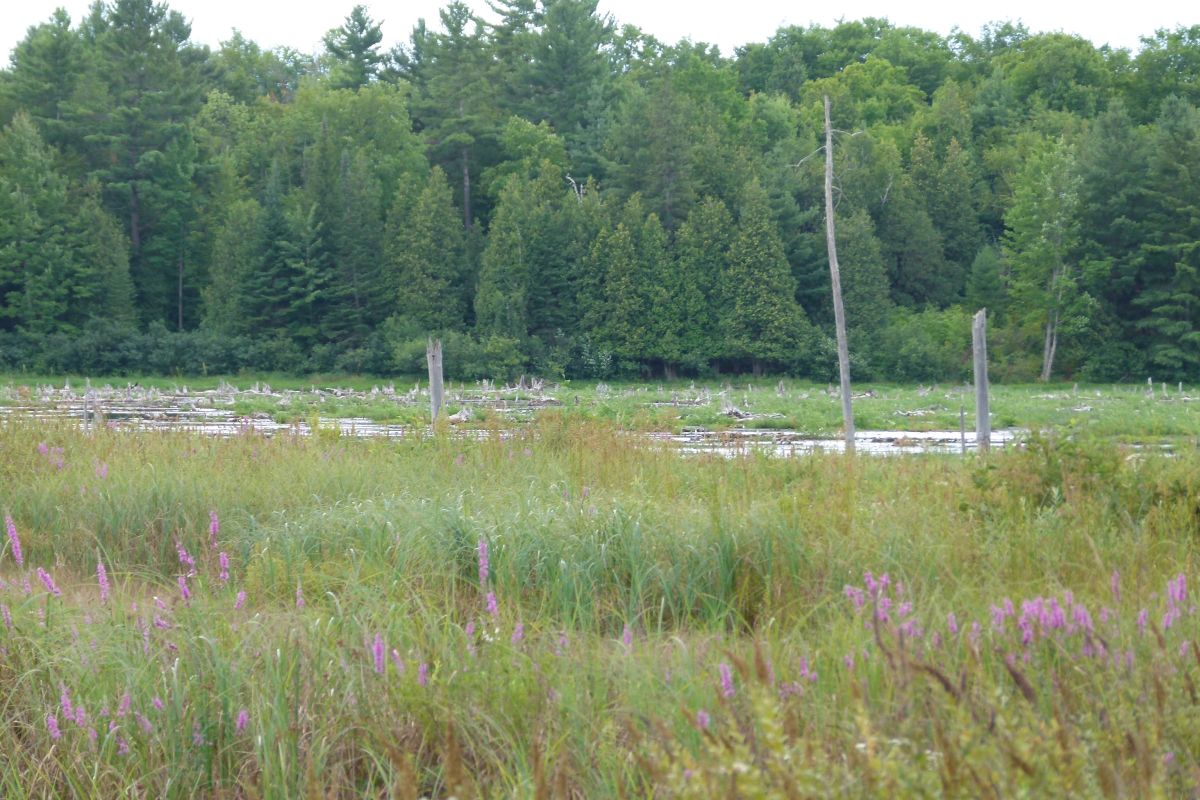
I do not wish to see the natural ruggedness and wilderness-like nature of the protected area compromised. One possibility is to build such a pathway around the “Beaver Pond”. This would also provide a place for casual walkers to enjoy the forest without ending up on the rugged natural trails in their high heels or sandals.

I understand the management plan will deal with the appropriate location of trailheads and parking facilities. I hope this will be done in such a way that natural features are not compromised. I would also suggest providing outhouses at the parking lots, as is done by the National Capital Commission at many of its parking lots in the greenbelt trail system.

Another issue that has been addressed by many trail users is the lack of signage, particularly due to the complexity of the trail system and the possibility of people getting lost. I trust this issue will be addressed in a way that detracts the least from the naturalness of the trails.

The last issue I want to address is public education. The official recognition of the South March Highlands Conservation Forest as a human-powered recreation area will make possible a more extensive public education program on responsible trail use. This has been something that the organized mountain biking community (OMBA) has been pursuing vigorously among its membership. However their membership does not include all trail users, and does not even include all mountain bikers. I would like to see the City fund an extensive public education program on responsible trail usage in co-operation with all trail user groups.

A good place to start in developing responsible trail use guidelines would be the IMBA Rules of the Trail.

Signage at the trail heads should include large trail maps on the signs along with responsible trail use guidelines. As well pamphlets with a map of the trails and the guidelines should be available.

I would also direct you to my previous comments on the South March Highlands Management Plan, “The South March Highlands - Kanata's Outdoor Wonderland”.

Maps of the South March Highlands and Kanata Lakes Trails

click on maps to enlarge


This has been sent to the South March Highlands Conservation Forest Management Plan project manager and the four councillors representing Kanata on Ottawa City Council.

2008-04-14

South March Highlands Management Plan Open House April 30

In November 2007 the Fifth Column discussed the South March Highlands Management Plan and the suggestion by the Kanata Environmental Network (KEN) that public use of the lands be kept to the periphery. Fortunately that view is not shared by any other environmental or user group, nor is it shared by the City of Ottawa.

If you want to know what is going on with the plans for the South March Highlands and want to have your say the public consultation process is about to begin. The first public meeting will be an open house from 7:00 to 9:00 PM at the Kanata Old Town Hall on March Road, near Klondike Road, on Wednesday April 30, 2008. This will be a relatively informal drop-in format as the consultants (Douglas and Ruhland Associates, landscape architects) “would rather engage and talk directly to those interested than have a formal presentation at this point in the process”.

Click here for a link to the Terms of Reference for the South March Highlands Management Plan, which includes the following information (extracts):

These forest lands include some of the most significant ecological features and functions within the City of Ottawa. It is the most ecologically diverse landscape in the City, overlies a section of the Canadian Shield and provides an exceptional natural environment experience. It also provides significant cultural and recreational resources with extensive use (hiking/walking and mountain biking being the two most prominent) by the immediate community, the larger City population, and in the case of some activities such as Mountain Biking, people living outside of the City.

Several issues have emerged in the area:

· The area is well known as a mountain biking and hiking/walking destination and at present, an extensive informal trail network has developed. There is the possibility that the location of certain sections of trail and/or the construction techniques that were used to build the trails are not necessarily consistent with the protection of natural values in the area. At the same time significant volunteer efforts have been made in recent years to implement lower impact trail construction techniques within the City owned conservation forest.

· Potential conflicts between users (nature appreciation, casual walkers, mountain bikers, hikers).

· Increased indirect impacts (edge effects, loss of interior habitat and connectivity ecological support systems) and use impacts as designated development areas build-out.

· There is no interpretative plan or efforts to direct the current range of users to protect or take advantage of features in the highlands.

· There is a lack of formal access or trail-head provisions.

· The need for a trail section or access for physically challenged residents has been raised.

· Limited existing tools to manage the form and intensity of recreational or other use in the area.

Objectives:

The overall objective is to design a management strategy that will provide long-term management direction for a 20 year period which provides for protection of the significant ecological features and functions of the South March Highlands while allowing users to experience the area through appropriate recreational activities in a way which is both manageable and sustainable in terms of the City’s, and stakeholder and user group resources.

The planning process will include:

· Participation in a project initiation open house to introduce the project to the community.

· Identification of use and management objectives through a stakeholder workshop and/or other consultation approaches to gain stakeholder input.

· Identification of opportunities for appropriate recreational use (open air recreation including hiking and biking, education, nature appreciation) and concerns related to inappropriate use and strategies to mitigate the effects of recreational use…

· Review and incorporation of best practices for low impact recreational use/trail development and management of near urban/urban natural features

· Develop detailed management recommendations

o Management of uses – where different uses should occur, how to control impacts.

o Management of future stressors (adjacent development, climate trends, invasive species)

o Recommendations related to connectivity to other landscape features within and outside the forest; and longer term strategic objectives for preservation of ecological integrity such as additions to the forest.

· Conceptual plan for infrastructure (recommendations for trail location, trail treatment, access).

o Trail location options (including an accessible trail)

o Trail treatment and design options

o Use management (signage, etc.)

o Access and potential trail head/ parking locations

o Interpretive resources (e.g. kiosk).
The Fifth Column hopes to see you all at the open house on April 30.

2008-04-11

Back On My Bike With My New GPS

Well spring has finally come, even if it has been interrupted for a few days, and I finally got back out on my bike. Early this week I got out on my Brodie Sterling hybrid for some rides around Kanata and the back country roads. I got to try out my new Garmin GPSMAP 60Cx GPS unit and I was very pleased with it. I am looking forward to getting back on the bike again early next week when the spring weather returns.

click on images to enlarge


2007-11-16

The South March Highlands - Kanata’s Outdoor Wonderland

I want to preface this by stating that I am a hiker and mountain biker, as well as a cross-country skier, but primarily I am an environmentalist.

On November 10, 2000 the Regional Municipality of Ottawa-Carleton announced the purchase of 556 acres of the South March Highlands for $1.6 million at the urging of Kanata Regional councilor Alex Munter who has stated “his biggest achievement would be putting South March Highland into public ownership to keep it protected.“

My attempt to find anything about the plans for the South March Highlands on the City of Ottawa website have been unsuccessful. All I could find were references to the fact that a plan should be drawn up.

However my own sources have confirmed that the process has begun with the city meeting with stakeholders and conducting another environmental assessment on the lands. I understand public meetings will be announced shortly.

Having heard rumours that some “environmentalists” wanted to restrict public access and trails to the periphery of the area I contacted the Kanata Environmental Network who provided this response:

“KEN has a representative attending the City meetings concerning the South March Highlands. The periphery approach is consistent with the environmental studies that Dan Brunton did over 20 years ago. There will be a new environmental assessment done in the next year and it may recommend keeping all human traffic on the edges. KEN is in favour of this approach. There is no other way to protect the heronry and multiple rare plant species in the highlands. KEN's stance reflects Brunton's recommendations until an update becomes available.”

This will come as a shock to the local community associations and activists who used Dan Brunton’s research in their fight to save the adjoining KNL lands from development and protect the trail network. They obviously have a different interpretation of Brunton’s position.

The fact is that this is urban parkland, not wilderness. It is surrounded by roads and the southern boundary is going to be a major roadway - Terry Fox Drive. Treating this land as wilderness with no interior public access simply does not make sense. One only needs to look at the response to KNL’s development proposals to know the public wants access to these lands.

And of course the trails are there and have existed for years and are being used by residents from all over Ottawa.

People can be a great threat to the environment, the biggest impact being from development - bulldozing and paving it over, blasting and replacing forests and meadows with parking lots and buildings.

On the other hand people hiking responsibly through the forest has no greater impact than deer or bears running through the forest, particularly when they are on a controlled trail system. The same applies to mountain biking where the scientific evidence indicates that hikers and mountain bikers and hikers have equivalent impacts on trails. See for example the reviews done by the International Mountain Bicycling Association and the New Zealand Department of Conservation.

The majority of outdoorspersons considers themselves to be, and indeed are, environmentalists. The best way to raise environmental awareness is by getting people out into the environment, enjoying it and learning of it’s importance and the need to protect it. That is where the environmentalists that we need to fight the real threats to the environment - development and habitat destruction, are born.

Getting people out into the environment, onto the lakes and rivers and into the forests builds healthy lifestyles, and healthy lifestyles improve our health and reduces our health care costs. This is important at a time when obesity, and childhood obesity in particular, is at epidemic levels. We need natural spaces and trails to teach our children the benefits and enjoyment that can be had in the great outdoors. Kanata is fortunate that we have a population that celebrates healthy lifestyles and rises up to challenge those that want to take our natural spaces and trails away from us.

Young people need the type of challenges the outdoors can provide as an alternative to spending their time a sedentary lifestyle centered on electronic devices, or other even worse but seemingly exciting activities, like gangs and drugs. Youth can be attracted to these things by the very risks we want to protect them from. Outdoors activities such as rock climbing and mountain biking can provide exciting healthy risks that build character and a healthy body.

The South March Highlands is an ideal location for the people of Kanata, young and old, to discover and enjoy a healthy outdoor lifestyle.

Fortunately we already have an environmentally friendly trail system in the South March Highlands, with natural, rugged, single track trails that have minimal environmental impact. These are the types of trails that hikers and mountain bikers love. The trail system is currently unofficially maintained by the Ottawa Mountain Bike Association according to the International Mountain Bicycling Association (IMBA) sustainable trail building standards which keeps the trails as natural as possible with some rock armouring used to raise low wet areas and some bridges over wet areas.

So what should the South March Highlands Management Plan propose for the existing trail system.

The trail system should be reviewed in light of the findings of the new environmental assessment, and in particular the identification of environmentally sensitive areas. It should also be reviewed in light of IMBA’s sustainable trail standards. This review would determine if any trail sections need to be rebuilt, closed or re-routed, as well as identifying possible additional trail routes.

Existing and new trails should be designed and maintained in as natural a state as possible, no widening, flattening, or paving should be allowed.

The South March Highlands belongs to all of us. The trails should be open to all users, with the exception of motorized vehicles, including snowmobiles.

In the summer we already have seen that the trails function exceedingly well as shared trails and they have the potential to become a model shared use trail system.

In the winter these rugged trails are ideal for snowshoeing, as well as mountain biking. Cross country skiers should also be welcome but these natural trails should not be altered into wide flat ski trails. There are lots of good wide flat ski trails available for skiing. These trails provide an excellent alternative for other trail users to avoid conflicts with skiers on the cross country ski trails.

The final, but perhaps most important part of the plan, should be public education on environmentally friendly and sustainable trail use, including respect for other trail users - share the trail. The education campaign should stress that trail users should stay on the designated trails. As well it should encourage trail users to avoid wet muddy trails but advise them to use the centre of the trail, not go alongside and widen it, if they do need to go through wet muddy sections. A good place to start with trail education are the IMBA Rules of the Trail

The residents of Kanata fought a valiant fight to try to protect the environmental lands and trail system within the KNL development lands, We still have the South March Highlands. It is time to build a plan that allows us to enjoy this environmental jewel in a responsible way that gets more people out enjoying the great outdoors and protects the environment.